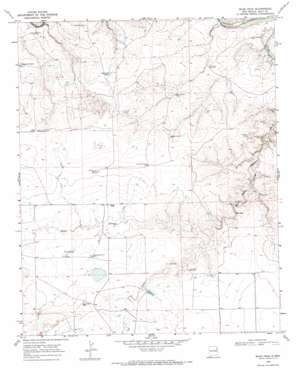
Blue Hole Topo Map New Mexico
To zoom in, hover over the map of Blue Hole
USGS Topo Quad 35103c2 - 1:24,000 scale
| Topo Map Name: | Blue Hole |
| USGS Topo Quad ID: | 35103c2 |
| Print Size: | ca. 21 1/4" wide x 27" high |
| Southeast Coordinates: | 35.25° N latitude / 103.125° W longitude |
| Map Center Coordinates: | 35.3125° N latitude / 103.1875° W longitude |
| U.S. State: | NM |
| Filename: | o35103c2.jpg |
| Download Map JPG Image: | Blue Hole topo map 1:24,000 scale |
| Map Type: | Topographic |
| Topo Series: | 7.5´ |
| Map Scale: | 1:24,000 |
| Source of Map Images: | United States Geological Survey (USGS) |
| Alternate Map Versions: |
Blue Hole NM 1968, updated 1971 Download PDF Buy paper map Blue Hole NM 2010 Download PDF Buy paper map Blue Hole NM 2013 Download PDF Buy paper map Blue Hole NM 2017 Download PDF Buy paper map |
1:24,000 Topo Quads surrounding Blue Hole
> Back to 35103a1 at 1:100,000 scale
> Back to 35102a1 at 1:250,000 scale
> Back to U.S. Topo Maps home
Blue Hole topo map: Gazetteer
Blue Hole: Reservoirs
East Side Tank elevation 1178m 3864′Mesquital Tank elevation 1140m 3740′
Blue Hole: Springs
Blue Hole elevation 1123m 3684′Blue Hole: Streams
Frost Creek elevation 1135m 3723′Blue Hole: Wells
05407 Water Well elevation 1162m 3812′05411 Water Well elevation 1186m 3891′
05412 Water Well elevation 1167m 3828′
05413 Water Well elevation 1169m 3835′
05426 Water Well elevation 1172m 3845′
05427 Water Well elevation 1183m 3881′
05428 Water Well elevation 1163m 3815′
05433 Water Well elevation 1175m 3854′
05516 Water Well elevation 1130m 3707′
05517 Water Well elevation 1179m 3868′
05519 Water Well elevation 1162m 3812′
05520 Water Well elevation 1189m 3900′
05523 Water Well elevation 1110m 3641′
05525 Water Well elevation 1135m 3723′
05527 Water Well elevation 1192m 3910′
05528 Water Well elevation 1192m 3910′
05529 Water Well elevation 1189m 3900′
Blue Hole digital topo map on disk
Buy this Blue Hole topo map showing relief, roads, GPS coordinates and other geographical features, as a high-resolution digital map file on DVD:


