Gallegos Topo Map New Mexico
To zoom in, hover over the map of Gallegos
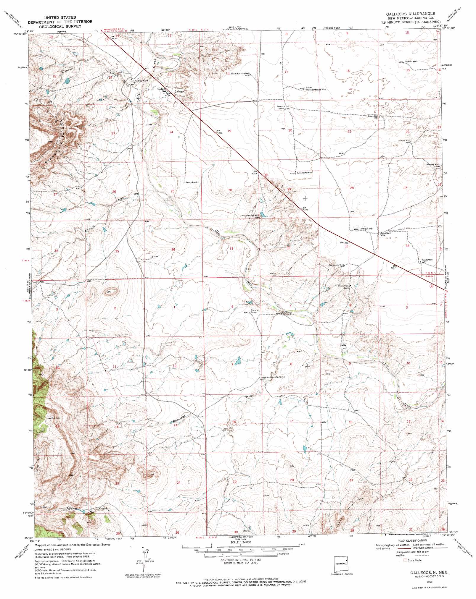
USGS Topo Quad 35103e6 - 1:24,000 scale
| Topo Map Name: | Gallegos |
| USGS Topo Quad ID: | 35103e6 |
| Print Size: | ca. 21 1/4" wide x 27" high |
| Southeast Coordinates: | 35.5° N latitude / 103.625° W longitude |
| Map Center Coordinates: | 35.5625° N latitude / 103.6875° W longitude |
| U.S. State: | NM |
| Filename: | o35103e6.jpg |
| Download Map JPG Image: | Gallegos topo map 1:24,000 scale |
| Map Type: | Topographic |
| Topo Series: | 7.5´ |
| Map Scale: | 1:24,000 |
| Source of Map Images: | United States Geological Survey (USGS) |
| Alternate Map Versions: |
Gallegos NM 1969, updated 1972 Download PDF Buy paper map Gallegos NM 2010 Download PDF Buy paper map Gallegos NM 2013 Download PDF Buy paper map Gallegos NM 2017 Download PDF Buy paper map |
1:24,000 Topo Quads surrounding Gallegos
Mosquero |
Arroyo Del Alamo |
Circle Bar Ranch |
Indian Bathtub |
Rosebud |
Chinaberry Canyon |
Salitre Canyon |
Buffalo Springs |
Gallegos Ne |
Mccloy Ranch |
Campana |
Alamosa Canyon |
Gallegos |
Fuentes Ranch |
Mccarty Ranch |
Carpenter Mesa Nw |
Medina Mesa |
Hampton Ranch |
Montesito Creek |
Logan North |
Carpenter Mesa Sw |
Trinchera Creek |
Bascom Camp |
Hudson |
Logan South |
> Back to 35103e1 at 1:100,000 scale
> Back to 35102a1 at 1:250,000 scale
> Back to U.S. Topo Maps home
Gallegos topo map: Gazetteer
Gallegos: Populated Places
Gallegos elevation 1262m 4140′Gallegos: Post Offices
Gallegos Post Office (historical) elevation 1262m 4140′Gallegos: Streams
Deposito Creek elevation 1247m 4091′Rincon Creek elevation 1240m 4068′
Gallegos: Valleys
Ramirez Draw elevation 1226m 4022′Gallegos: Wells
Antique Well elevation 1287m 4222′Askins Well elevation 1305m 4281′
Clendenin Well elevation 1284m 4212′
Creek Pasture Well elevation 1250m 4101′
Flowers Well elevation 1318m 4324′
Jones Well elevation 1308m 4291′
Mare Pasture Well elevation 1301m 4268′
Ramsey Well elevation 1302m 4271′
Reed Well elevation 1284m 4212′
South House Pasture Well elevation 1306m 4284′
Tinkle Well elevation 1283m 4209′
Gallegos digital topo map on disk
Buy this Gallegos topo map showing relief, roads, GPS coordinates and other geographical features, as a high-resolution digital map file on DVD: