Circle Bar Ranch Topo Map New Mexico
To zoom in, hover over the map of Circle Bar Ranch
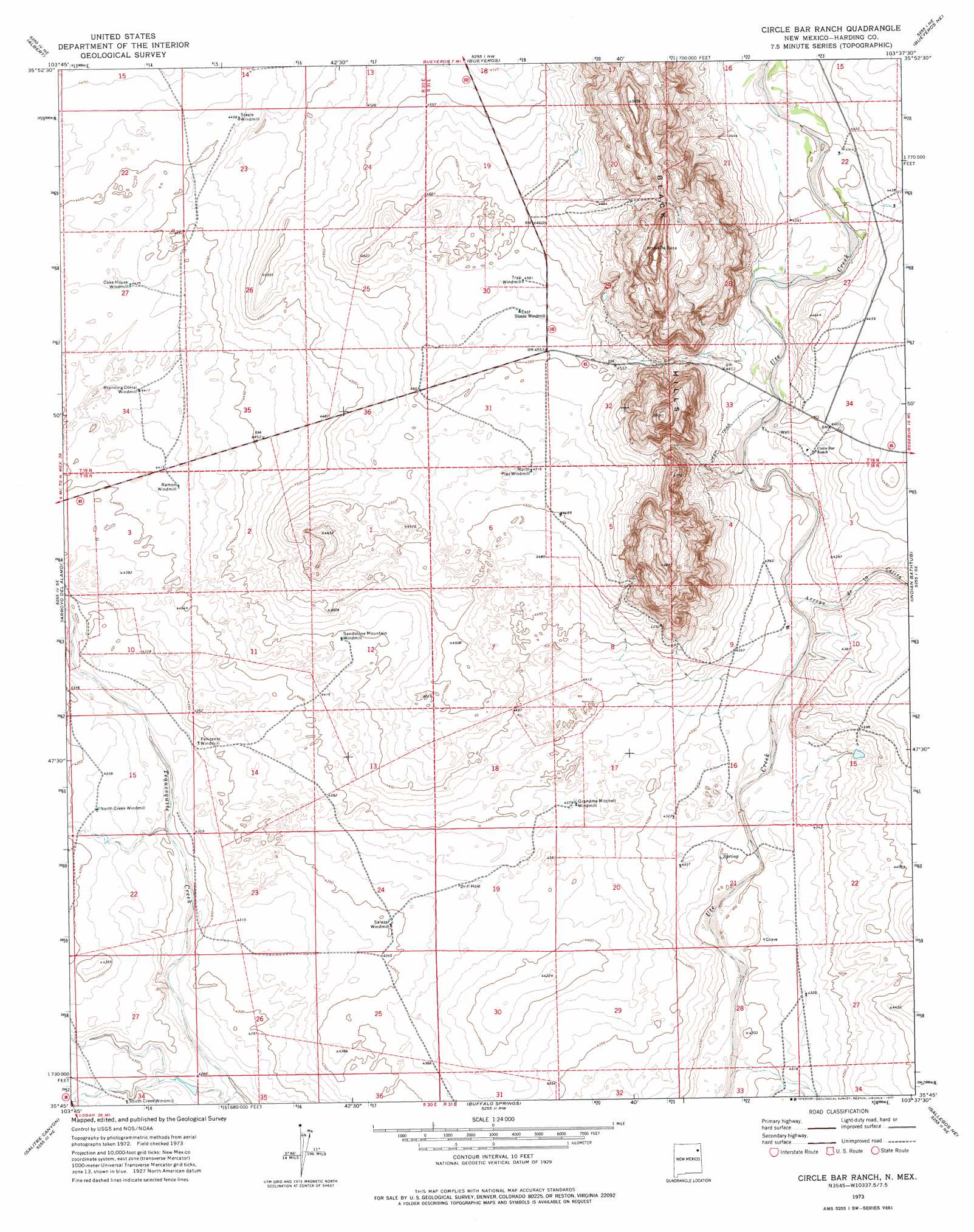
USGS Topo Quad 35103g6 - 1:24,000 scale
| Topo Map Name: | Circle Bar Ranch |
| USGS Topo Quad ID: | 35103g6 |
| Print Size: | ca. 21 1/4" wide x 27" high |
| Southeast Coordinates: | 35.75° N latitude / 103.625° W longitude |
| Map Center Coordinates: | 35.8125° N latitude / 103.6875° W longitude |
| U.S. State: | NM |
| Filename: | o35103g6.jpg |
| Download Map JPG Image: | Circle Bar Ranch topo map 1:24,000 scale |
| Map Type: | Topographic |
| Topo Series: | 7.5´ |
| Map Scale: | 1:24,000 |
| Source of Map Images: | United States Geological Survey (USGS) |
| Alternate Map Versions: |
Circle Bar Ranch NM 1973, updated 1977 Download PDF Buy paper map Circle Bar Ranch NM 2010 Download PDF Buy paper map Circle Bar Ranch NM 2013 Download PDF Buy paper map Circle Bar Ranch NM 2017 Download PDF Buy paper map |
1:24,000 Topo Quads surrounding Circle Bar Ranch
Valencia Spring |
Yates Se |
Beenham Sw |
Minnie Butte |
Pedernal Creek |
Sabino |
Albert |
Bueyeros |
Bueyeros Ne |
Cottonwood Springs |
Mosquero |
Arroyo Del Alamo |
Circle Bar Ranch |
Indian Bathtub |
Rosebud |
Chinaberry Canyon |
Salitre Canyon |
Buffalo Springs |
Gallegos Ne |
Mccloy Ranch |
Campana |
Alamosa Canyon |
Gallegos |
Fuentes Ranch |
Mccarty Ranch |
> Back to 35103e1 at 1:100,000 scale
> Back to 35102a1 at 1:250,000 scale
> Back to U.S. Topo Maps home
Circle Bar Ranch topo map: Gazetteer
Circle Bar Ranch: Ridges
Black Hills elevation 1480m 4855′Circle Bar Ranch: Streams
Arroyo de la Cejita elevation 1320m 4330′Arroyo del Alamo elevation 1318m 4324′
Circle Bar Ranch: Summits
Steele Windmill elevation 1360m 4461′Circle Bar Ranch digital topo map on disk
Buy this Circle Bar Ranch topo map showing relief, roads, GPS coordinates and other geographical features, as a high-resolution digital map file on DVD: