Amistad Topo Map New Mexico
To zoom in, hover over the map of Amistad
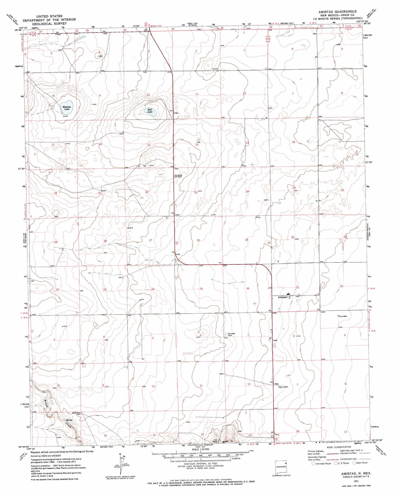
USGS Topo Quad 35103h2 - 1:24,000 scale
| Topo Map Name: | Amistad |
| USGS Topo Quad ID: | 35103h2 |
| Print Size: | ca. 21 1/4" wide x 27" high |
| Southeast Coordinates: | 35.875° N latitude / 103.125° W longitude |
| Map Center Coordinates: | 35.9375° N latitude / 103.1875° W longitude |
| U.S. State: | NM |
| Filename: | o35103h2.jpg |
| Download Map JPG Image: | Amistad topo map 1:24,000 scale |
| Map Type: | Topographic |
| Topo Series: | 7.5´ |
| Map Scale: | 1:24,000 |
| Source of Map Images: | United States Geological Survey (USGS) |
| Alternate Map Versions: |
Amistad NM 1971, updated 1973 Download PDF Buy paper map Amistad NM 2010 Download PDF Buy paper map Amistad NM 2013 Download PDF Buy paper map Amistad NM 2017 Download PDF Buy paper map |
1:24,000 Topo Quads surrounding Amistad
Car Top Butte |
Clapham |
Sedan |
Sedan Ne |
Windy Hill Nw |
Pedernal Creek |
Skull Mesa |
Stead |
Sedan Se |
Windy Hill |
Cottonwood Springs |
Hayden |
Amistad |
Koger Ranch |
Beck Ranch |
Rosebud |
Ione |
Centerville Corner |
Amistad Se |
Whiteaker Ranch |
Mccloy Ranch |
Cherokee Valley |
Kerlin Hill |
Doyle Hill |
Romero |
> Back to 35103e1 at 1:100,000 scale
> Back to 35102a1 at 1:250,000 scale
> Back to U.S. Topo Maps home
Amistad topo map: Gazetteer
Amistad: Lakes
Maestas Lake elevation 1400m 4593′Salt Lake elevation 1380m 4527′
Amistad: Populated Places
Amistad elevation 1363m 4471′Amistad: Post Offices
Amistad Post Office elevation 1363m 4471′Amistad: Wells
Culp Well elevation 1352m 4435′Dave Well elevation 1404m 4606′
Ellis Well elevation 1367m 4484′
Amistad digital topo map on disk
Buy this Amistad topo map showing relief, roads, GPS coordinates and other geographical features, as a high-resolution digital map file on DVD: