Sabino Topo Map New Mexico
To zoom in, hover over the map of Sabino
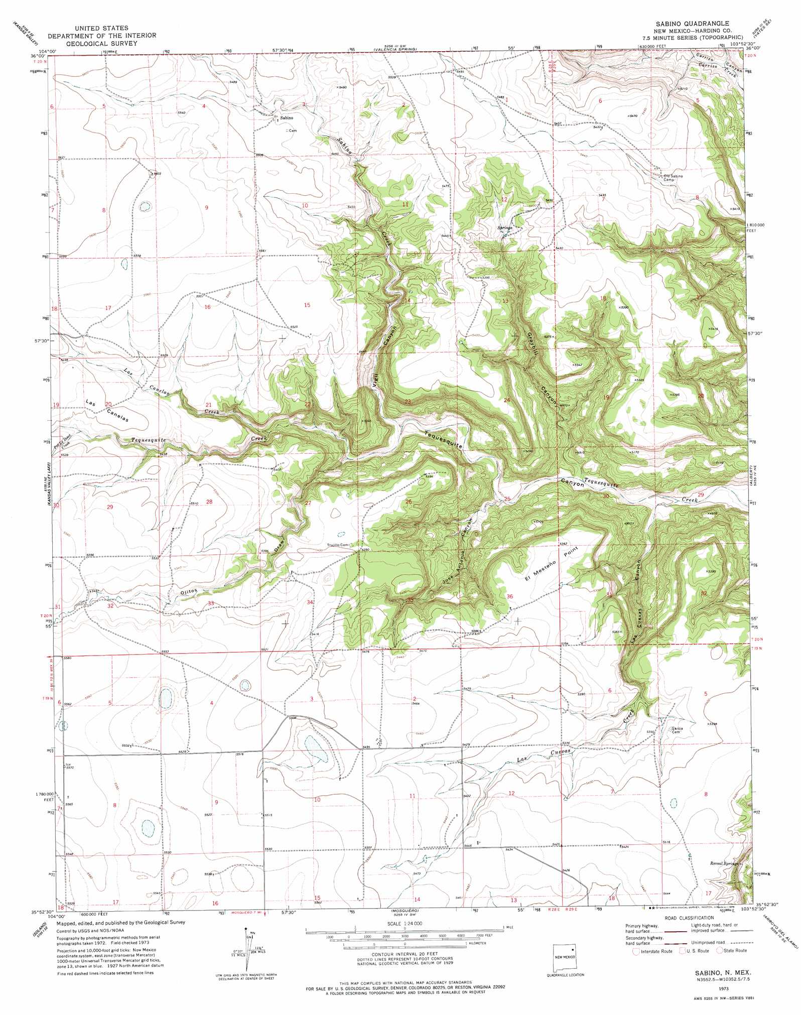
USGS Topo Quad 35103h8 - 1:24,000 scale
| Topo Map Name: | Sabino |
| USGS Topo Quad ID: | 35103h8 |
| Print Size: | ca. 21 1/4" wide x 27" high |
| Southeast Coordinates: | 35.875° N latitude / 103.875° W longitude |
| Map Center Coordinates: | 35.9375° N latitude / 103.9375° W longitude |
| U.S. State: | NM |
| Filename: | o35103h8.jpg |
| Download Map JPG Image: | Sabino topo map 1:24,000 scale |
| Map Type: | Topographic |
| Topo Series: | 7.5´ |
| Map Scale: | 1:24,000 |
| Source of Map Images: | United States Geological Survey (USGS) |
| Alternate Map Versions: |
Sabino NM 1973, updated 1978 Download PDF Buy paper map Sabino NM 2010 Download PDF Buy paper map Sabino NM 2013 Download PDF Buy paper map Sabino NM 2017 Download PDF Buy paper map |
1:24,000 Topo Quads surrounding Sabino
Spear Hills |
Divine Lake |
Yates |
Aragon Hill |
Beenham |
Mills East |
Kansas Valley |
Valencia Spring |
Yates Se |
Beenham Sw |
Roy |
Kansas Valley Lake |
Sabino |
Albert |
Bueyeros |
La Cinta Canyon |
Solano |
Mosquero |
Arroyo Del Alamo |
Circle Bar Ranch |
Montoya Point |
Waggoner Ranch |
Chinaberry Canyon |
Salitre Canyon |
Buffalo Springs |
> Back to 35103e1 at 1:100,000 scale
> Back to 35102a1 at 1:250,000 scale
> Back to U.S. Topo Maps home
Sabino topo map: Gazetteer
Sabino: Areas
Las Canelas elevation 1678m 5505′Sabino: Capes
El Mesteño Point elevation 1630m 5347′Sabino: Populated Places
Sabino elevation 1670m 5479′Sabino: Springs
Revoal Springs elevation 1580m 5183′Revoal Springs elevation 1588m 5209′
Sabino: Streams
Las Canelas Creek elevation 1573m 5160′Las Cuevas Creek elevation 1431m 4694′
Pat Le Doux Creek elevation 1658m 5439′
Sabino Creek elevation 1493m 4898′
Sabino: Summits
Circle S Mesa elevation 1573m 5160′Sabino: Valleys
Graybill Canyon elevation 1451m 4760′Jose Antonio Canyon elevation 1456m 4776′
Las Cuevas Canyon elevation 1433m 4701′
Ojitos Draw elevation 1517m 4977′
Vigil Canyon elevation 1501m 4924′
Sabino digital topo map on disk
Buy this Sabino topo map showing relief, roads, GPS coordinates and other geographical features, as a high-resolution digital map file on DVD: