Mesa Cherisco Topo Map New Mexico
To zoom in, hover over the map of Mesa Cherisco
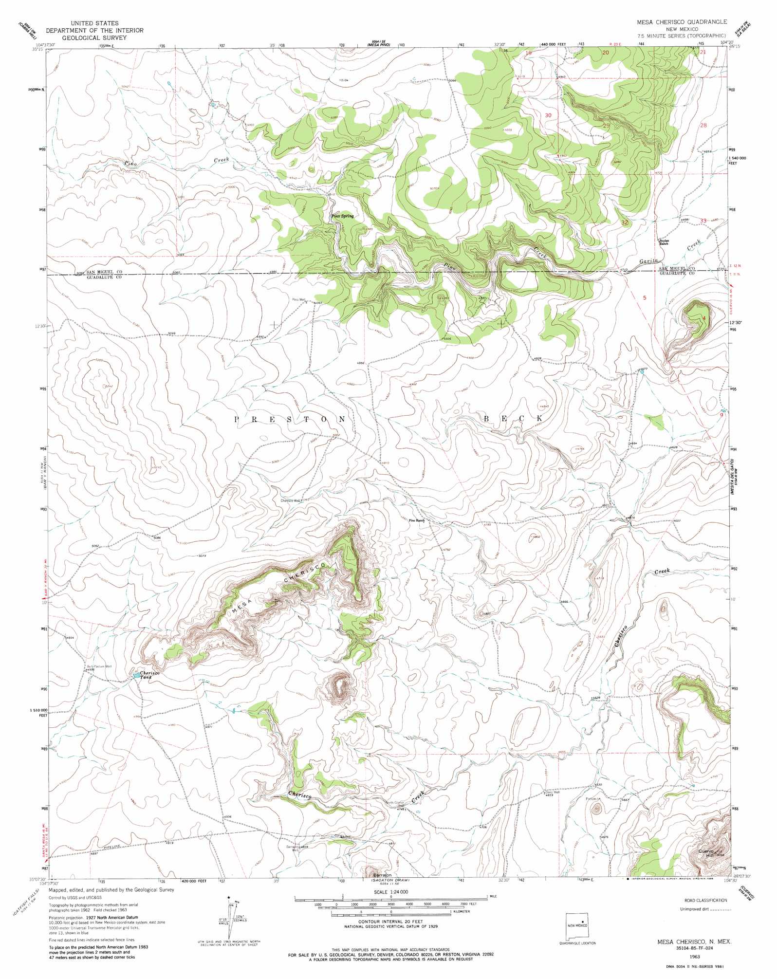
USGS Topo Quad 35104b5 - 1:24,000 scale
| Topo Map Name: | Mesa Cherisco |
| USGS Topo Quad ID: | 35104b5 |
| Print Size: | ca. 21 1/4" wide x 27" high |
| Southeast Coordinates: | 35.125° N latitude / 104.5° W longitude |
| Map Center Coordinates: | 35.1875° N latitude / 104.5625° W longitude |
| U.S. State: | NM |
| Filename: | o35104b5.jpg |
| Download Map JPG Image: | Mesa Cherisco topo map 1:24,000 scale |
| Map Type: | Topographic |
| Topo Series: | 7.5´ |
| Map Scale: | 1:24,000 |
| Source of Map Images: | United States Geological Survey (USGS) |
| Alternate Map Versions: |
Mesa Cherisco NM 1963, updated 1965 Download PDF Buy paper map Mesa Cherisco NM 1963, updated 1986 Download PDF Buy paper map Mesa Cherisco NM 2010 Download PDF Buy paper map Mesa Cherisco NM 2013 Download PDF Buy paper map Mesa Cherisco NM 2017 Download PDF Buy paper map |
1:24,000 Topo Quads surrounding Mesa Cherisco
Flagstone Mountain |
Punta Del Chorro |
Cerro De Corazon |
Variadero |
Four V Ranch |
Cactus Tank |
Cabra Hill |
Mesa Pino |
La Silla |
Bookout Ranch |
Horse Pasture Tank |
Bar Y Ranch |
Mesa Cherisco |
Mesita Del Gato |
Neafus Ranch |
Colonias |
Catfish Falls |
Sacaton Draw |
Cuervo |
Newkirk |
Pastura Ne |
Santa Rosa |
Sunshine Mesa |
Harben Lake |
Salt Lake |
> Back to 35104a1 at 1:100,000 scale
> Back to 35104a1 at 1:250,000 scale
> Back to U.S. Topo Maps home
Mesa Cherisco topo map: Gazetteer
Mesa Cherisco: Reservoirs
Cherisco Tank elevation 1515m 4970′Mesa Cherisco: Springs
Pino Spring elevation 1495m 4904′Mesa Cherisco: Summits
Barrajon elevation 1540m 5052′Cuervo Hill elevation 1628m 5341′
Mesa Cherisco elevation 1642m 5387′
Mesa Cherisco: Wells
Barrajon Well elevation 1481m 4858′Bull Pasture Well elevation 1503m 4931′
Cherisco Well elevation 1516m 4973′
Deep Well elevation 1420m 4658′
North Corner Well elevation 1446m 4744′
Pino Well elevation 1515m 4970′
Mesa Cherisco digital topo map on disk
Buy this Mesa Cherisco topo map showing relief, roads, GPS coordinates and other geographical features, as a high-resolution digital map file on DVD: