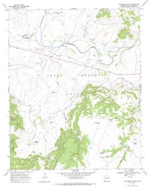
Monument Point Topo Map New Mexico
To zoom in, hover over the map of Monument Point
USGS Topo Quad 35104c1 - 1:24,000 scale
| Topo Map Name: | Monument Point |
| USGS Topo Quad ID: | 35104c1 |
| Print Size: | ca. 21 1/4" wide x 27" high |
| Southeast Coordinates: | 35.25° N latitude / 104° W longitude |
| Map Center Coordinates: | 35.3125° N latitude / 104.0625° W longitude |
| U.S. State: | NM |
| Filename: | o35104c1.jpg |
| Download Map JPG Image: | Monument Point topo map 1:24,000 scale |
| Map Type: | Topographic |
| Topo Series: | 7.5´ |
| Map Scale: | 1:24,000 |
| Source of Map Images: | United States Geological Survey (USGS) |
| Alternate Map Versions: |
Monument Point NM 1967, updated 1971 Download PDF Buy paper map Monument Point NM 1967, updated 1986 Download PDF Buy paper map Monument Point NM 2010 Download PDF Buy paper map Monument Point NM 2013 Download PDF Buy paper map Monument Point NM 2017 Download PDF Buy paper map |
1:24,000 Topo Quads surrounding Monument Point
> Back to 35104a1 at 1:100,000 scale
> Back to 35104a1 at 1:250,000 scale
> Back to U.S. Topo Maps home
Monument Point topo map: Gazetteer
Monument Point: Reservoirs
Chical Tank elevation 1385m 4543′East Tank elevation 1464m 4803′
Mistake Tank elevation 1488m 4881′
Monument Tank elevation 1482m 4862′
Point Tank elevation 1464m 4803′
Tito Tank elevation 1265m 4150′
Twin Tanks elevation 1228m 4028′
West Tank elevation 1469m 4819′
Monument Point: Streams
Chical Creek elevation 1206m 3956′Comancheros Creek elevation 1232m 4041′
Corralitos Creek elevation 1256m 4120′
La Manga Creek elevation 1210m 3969′
Oso Creek elevation 1213m 3979′
Monument Point: Summits
Monument Point elevation 1489m 4885′Monument Point: Tunnels
Tunnel Number 2 elevation 1363m 4471′Monument Point digital topo map on disk
Buy this Monument Point topo map showing relief, roads, GPS coordinates and other geographical features, as a high-resolution digital map file on DVD:


