La Silla Topo Map New Mexico
To zoom in, hover over the map of La Silla
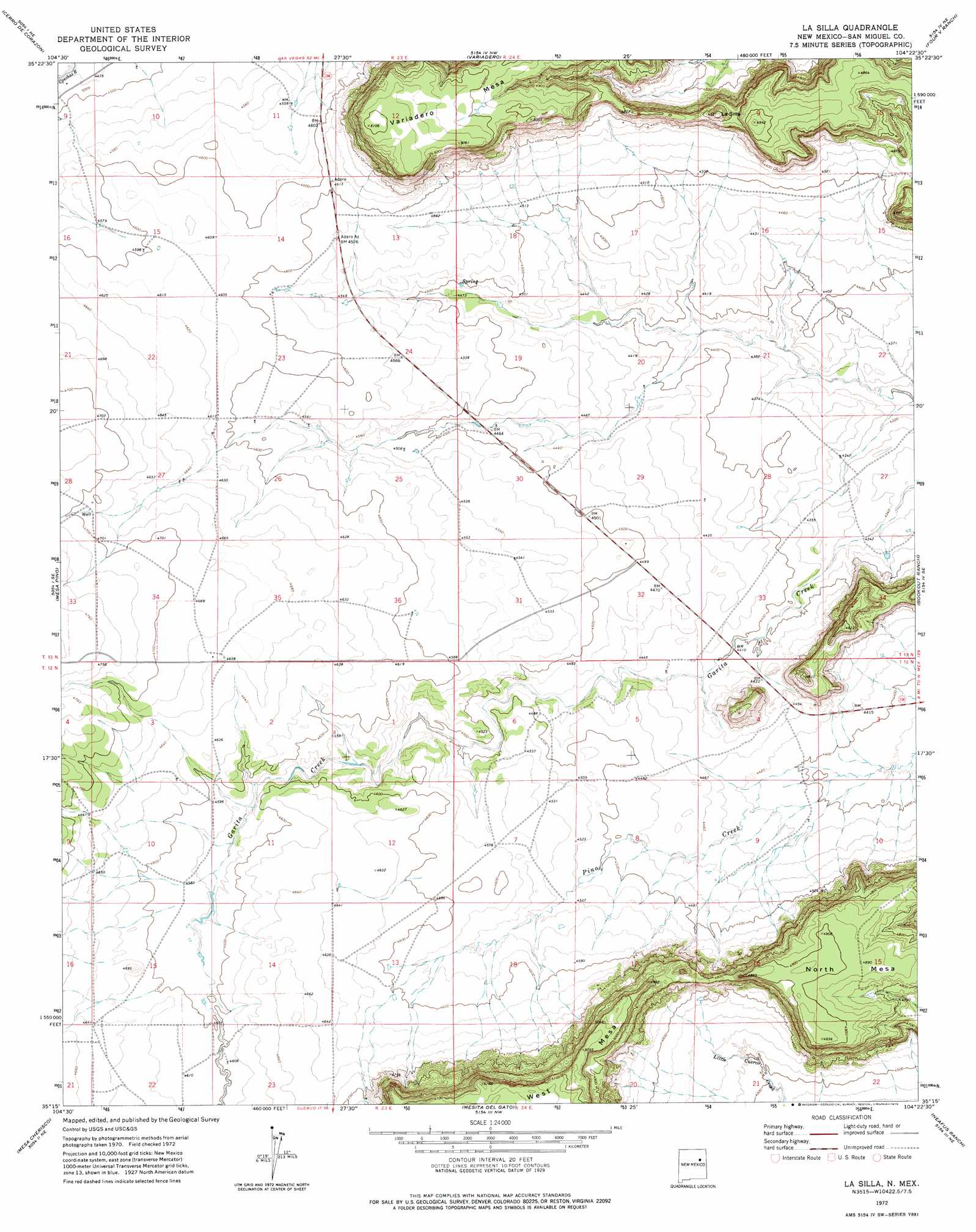
USGS Topo Quad 35104c4 - 1:24,000 scale
| Topo Map Name: | La Silla |
| USGS Topo Quad ID: | 35104c4 |
| Print Size: | ca. 21 1/4" wide x 27" high |
| Southeast Coordinates: | 35.25° N latitude / 104.375° W longitude |
| Map Center Coordinates: | 35.3125° N latitude / 104.4375° W longitude |
| U.S. State: | NM |
| Filename: | o35104c4.jpg |
| Download Map JPG Image: | La Silla topo map 1:24,000 scale |
| Map Type: | Topographic |
| Topo Series: | 7.5´ |
| Map Scale: | 1:24,000 |
| Source of Map Images: | United States Geological Survey (USGS) |
| Alternate Map Versions: |
La Silla NM 1972, updated 1975 Download PDF Buy paper map La Silla NM 2010 Download PDF Buy paper map La Silla NM 2013 Download PDF Buy paper map La Silla NM 2017 Download PDF Buy paper map |
1:24,000 Topo Quads surrounding La Silla
Trujillo |
Canon Olguin |
San Ramon |
Wade Canyon |
Minese Mesa |
Punta Del Chorro |
Cerro De Corazon |
Variadero |
Four V Ranch |
Conchas Dam |
Cabra Hill |
Mesa Pino |
La Silla |
Bookout Ranch |
Tenaja Mesa |
Bar Y Ranch |
Mesa Cherisco |
Mesita Del Gato |
Neafus Ranch |
Ortega Tank |
Catfish Falls |
Sacaton Draw |
Cuervo |
Newkirk |
Gate Canyon |
> Back to 35104a1 at 1:100,000 scale
> Back to 35104a1 at 1:250,000 scale
> Back to U.S. Topo Maps home
La Silla topo map: Gazetteer
La Silla: Mines
Neafus Claims elevation 1414m 4639′La Silla: Populated Places
Adero Az elevation 1395m 4576′La Silla: Post Offices
Garita Post Office (historical) elevation 1403m 4603′La Silla: Summits
La Silla elevation 1493m 4898′North Mesa elevation 1481m 4858′
Variadero Mesa elevation 1557m 5108′
La Silla digital topo map on disk
Buy this La Silla topo map showing relief, roads, GPS coordinates and other geographical features, as a high-resolution digital map file on DVD: