Maes Topo Map New Mexico
To zoom in, hover over the map of Maes
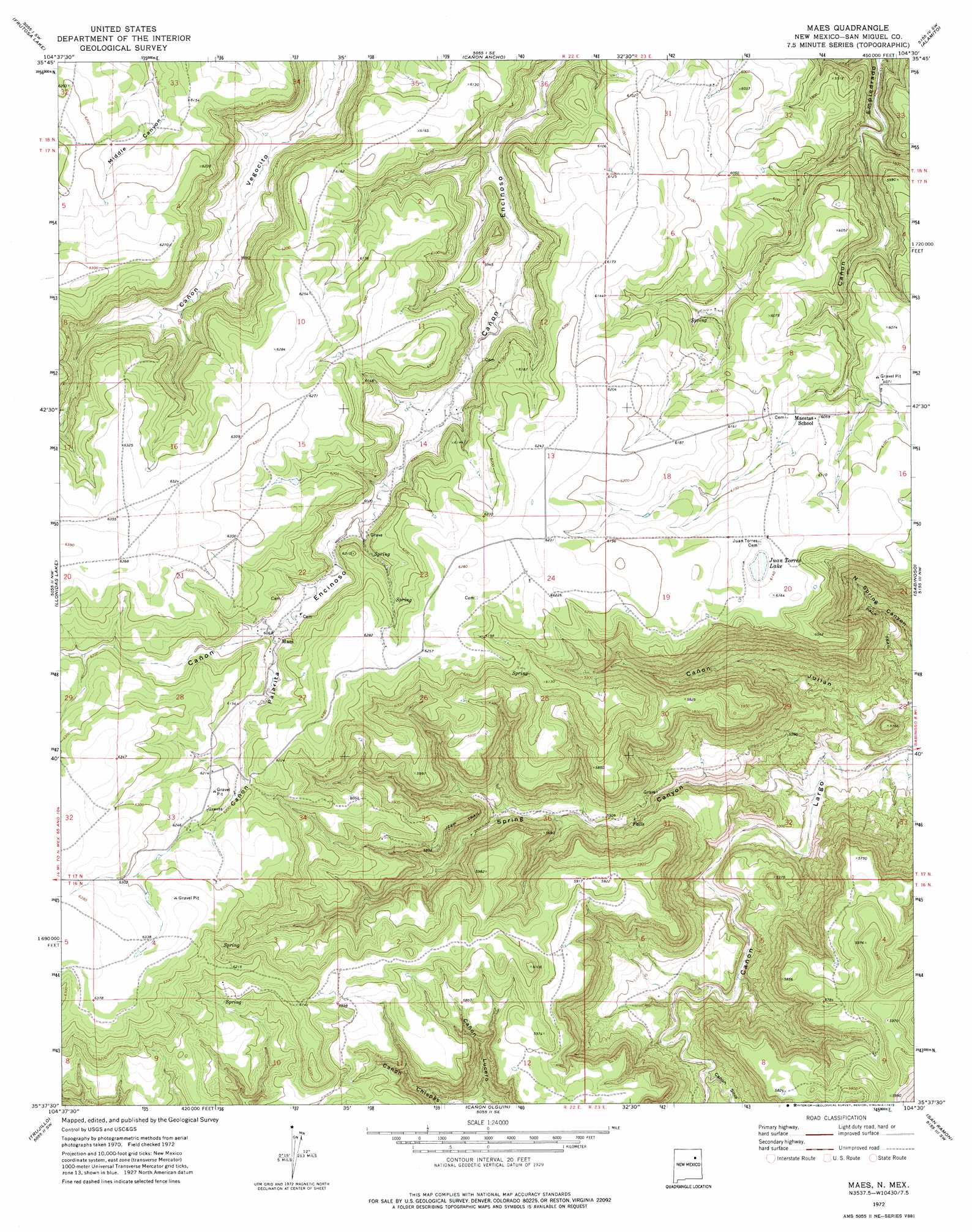
USGS Topo Quad 35104f5 - 1:24,000 scale
| Topo Map Name: | Maes |
| USGS Topo Quad ID: | 35104f5 |
| Print Size: | ca. 21 1/4" wide x 27" high |
| Southeast Coordinates: | 35.625° N latitude / 104.5° W longitude |
| Map Center Coordinates: | 35.6875° N latitude / 104.5625° W longitude |
| U.S. State: | NM |
| Filename: | o35104f5.jpg |
| Download Map JPG Image: | Maes topo map 1:24,000 scale |
| Map Type: | Topographic |
| Topo Series: | 7.5´ |
| Map Scale: | 1:24,000 |
| Source of Map Images: | United States Geological Survey (USGS) |
| Alternate Map Versions: |
Maes NM 1972, updated 1975 Download PDF Buy paper map Maes NM 2010 Download PDF Buy paper map Maes NM 2013 Download PDF Buy paper map Maes NM 2017 Download PDF Buy paper map |
1:24,000 Topo Quads surrounding Maes
Optimo |
Mogote Hills |
Alamosa Creek |
Canon Las Cuevas |
Beaver Canyon |
Cherry Valley Lake |
Frutosa Lake |
Canon Ancho |
Alamito |
Canon Encierro |
Canon Pedroso |
Llonidas Lake |
Maes |
Sabinoso |
Arroyo Alamocito |
Laguna Huerfana |
Trujillo |
Canon Olguin |
San Ramon |
Wade Canyon |
Flagstone Mountain |
Punta Del Chorro |
Cerro De Corazon |
Variadero |
Four V Ranch |
> Back to 35104e1 at 1:100,000 scale
> Back to 35104a1 at 1:250,000 scale
> Back to U.S. Topo Maps home
Maes topo map: Gazetteer
Maes: Lakes
Juan Torres Lake elevation 1864m 6115′Maes: Post Offices
Maes Post Office (historical) elevation 1849m 6066′Maes: Valleys
Canon Chispas elevation 1641m 5383′Canon Lucero elevation 1639m 5377′
Cañon Pajarita elevation 1850m 6069′
Cañon Silva elevation 1584m 5196′
Spring Canyon elevation 1483m 4865′
Maes digital topo map on disk
Buy this Maes topo map showing relief, roads, GPS coordinates and other geographical features, as a high-resolution digital map file on DVD: