La Cinta Canyon Topo Map New Mexico
To zoom in, hover over the map of La Cinta Canyon
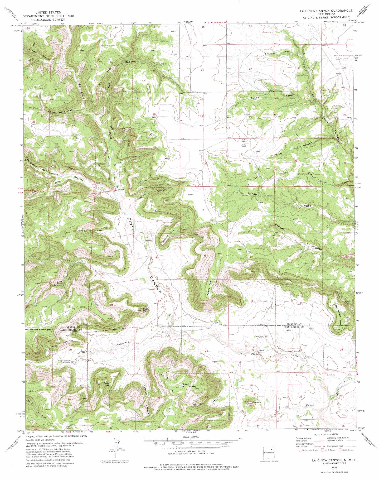
USGS Topo Quad 35104g2 - 1:24,000 scale
| Topo Map Name: | La Cinta Canyon |
| USGS Topo Quad ID: | 35104g2 |
| Print Size: | ca. 21 1/4" wide x 27" high |
| Southeast Coordinates: | 35.75° N latitude / 104.125° W longitude |
| Map Center Coordinates: | 35.8125° N latitude / 104.1875° W longitude |
| U.S. State: | NM |
| Filename: | o35104g2.jpg |
| Download Map JPG Image: | La Cinta Canyon topo map 1:24,000 scale |
| Map Type: | Topographic |
| Topo Series: | 7.5´ |
| Map Scale: | 1:24,000 |
| Source of Map Images: | United States Geological Survey (USGS) |
| Alternate Map Versions: |
La Cinta Canyon NM 1978, updated 1978 Download PDF Buy paper map La Cinta Canyon NM 2010 Download PDF Buy paper map La Cinta Canyon NM 2013 Download PDF Buy paper map La Cinta Canyon NM 2017 Download PDF Buy paper map |
1:24,000 Topo Quads surrounding La Cinta Canyon
Canon Colorado |
Mills West |
Mills East |
Kansas Valley |
Valencia Spring |
Canon Las Cuevas |
Beaver Canyon |
Roy |
Kansas Valley Lake |
Sabino |
Alamito |
Canon Encierro |
La Cinta Canyon |
Solano |
Mosquero |
Sabinoso |
Arroyo Alamocito |
Montoya Point |
Waggoner Ranch |
Chinaberry Canyon |
San Ramon |
Wade Canyon |
Minese Mesa |
Bell Ranch |
Campana |
> Back to 35104e1 at 1:100,000 scale
> Back to 35104a1 at 1:250,000 scale
> Back to U.S. Topo Maps home
La Cinta Canyon topo map: Gazetteer
La Cinta Canyon: Streams
Burro Creek elevation 1444m 4737′La Cinta Canyon: Summits
Apache Point elevation 1776m 5826′Deer Mountain elevation 1789m 5869′
Flatiron elevation 1589m 5213′
Gato Point elevation 1635m 5364′
Kicking Foot Mesa elevation 1685m 5528′
Red Tongue Mesa elevation 1551m 5088′
Turkey Head elevation 1729m 5672′
La Cinta Canyon: Valleys
Archuleta Canyon elevation 1546m 5072′Cañon Bestias elevation 1517m 4977′
Cañon de Librador elevation 1555m 5101′
Cañon Gato elevation 1512m 4960′
Cañon Lavirgn elevation 1670m 5479′
Cañon Poniente elevation 1489m 4885′
Cañon Toro elevation 1526m 5006′
Farmers Canyon elevation 1489m 4885′
Flatiron Canyon elevation 1497m 4911′
Hells Canyon elevation 1547m 5075′
La Cinta Canyon elevation 1473m 4832′
Lucero Canyon elevation 1577m 5173′
Morris Canyon elevation 1524m 5000′
Porter Canyon elevation 1652m 5419′
School Section Draw elevation 1631m 5351′
Shannon Canyon elevation 1702m 5583′
Wright Canyon elevation 1563m 5127′
La Cinta Canyon digital topo map on disk
Buy this La Cinta Canyon topo map showing relief, roads, GPS coordinates and other geographical features, as a high-resolution digital map file on DVD: