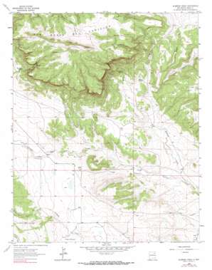
Alamosa Creek Topo Map New Mexico
To zoom in, hover over the map of Alamosa Creek
USGS Topo Quad 35104h5 - 1:24,000 scale
| Topo Map Name: | Alamosa Creek |
| USGS Topo Quad ID: | 35104h5 |
| Print Size: | ca. 21 1/4" wide x 27" high |
| Southeast Coordinates: | 35.875° N latitude / 104.5° W longitude |
| Map Center Coordinates: | 35.9375° N latitude / 104.5625° W longitude |
| U.S. State: | NM |
| Filename: | o35104h5.jpg |
| Download Map JPG Image: | Alamosa Creek topo map 1:24,000 scale |
| Map Type: | Topographic |
| Topo Series: | 7.5´ |
| Map Scale: | 1:24,000 |
| Source of Map Images: | United States Geological Survey (USGS) |
| Alternate Map Versions: |
Alamosa Creek NM 1964, updated 1966 Download PDF Buy paper map Alamosa Creek NM 1964, updated 1990 Download PDF Buy paper map Alamosa Creek NM 2010 Download PDF Buy paper map Alamosa Creek NM 2013 Download PDF Buy paper map Alamosa Creek NM 2017 Download PDF Buy paper map |
1:24,000 Topo Quads surrounding Alamosa Creek
> Back to 35104e1 at 1:100,000 scale
> Back to 35104a1 at 1:250,000 scale
> Back to U.S. Topo Maps home
Alamosa Creek topo map: Gazetteer
Alamosa Creek: Mines
Mobil 1 Wooten elevation 1824m 5984′Alamosa Creek: Reservoirs
MacArthur Tank elevation 2049m 6722′Alamosa Creek: Springs
Bootlegger Spring elevation 1910m 6266′El Rincon Spring elevation 1823m 5980′
Mayes Spring elevation 1775m 5823′
Alamosa Creek: Streams
Alamosa Creek elevation 1675m 5495′Vermejo Creek elevation 1779m 5836′
Alamosa Creek: Summits
Cuernudo Hills elevation 1935m 6348′Alamosa Creek: Valleys
Cañon Alamito elevation 1793m 5882′Cañon Bonito elevation 1756m 5761′
Alamosa Creek digital topo map on disk
Buy this Alamosa Creek topo map showing relief, roads, GPS coordinates and other geographical features, as a high-resolution digital map file on DVD:


