Mesa Palo Amarillo Topo Map New Mexico
To zoom in, hover over the map of Mesa Palo Amarillo
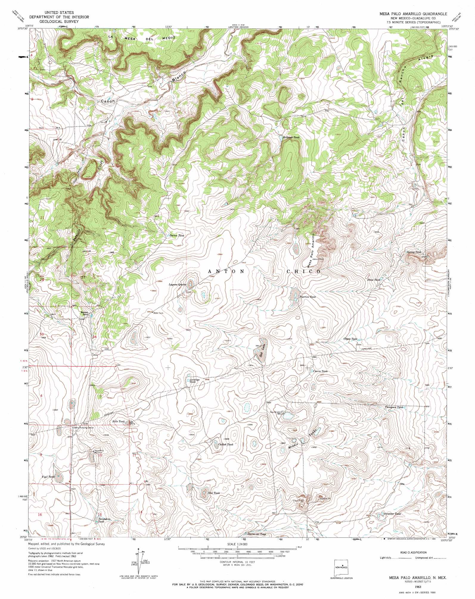
USGS Topo Quad 35105a2 - 1:24,000 scale
| Topo Map Name: | Mesa Palo Amarillo |
| USGS Topo Quad ID: | 35105a2 |
| Print Size: | ca. 21 1/4" wide x 27" high |
| Southeast Coordinates: | 35° N latitude / 105.125° W longitude |
| Map Center Coordinates: | 35.0625° N latitude / 105.1875° W longitude |
| U.S. State: | NM |
| Filename: | o35105a2.jpg |
| Download Map JPG Image: | Mesa Palo Amarillo topo map 1:24,000 scale |
| Map Type: | Topographic |
| Topo Series: | 7.5´ |
| Map Scale: | 1:24,000 |
| Source of Map Images: | United States Geological Survey (USGS) |
| Alternate Map Versions: |
Mesa Palo Amarillo NM 1963, updated 1966 Download PDF Buy paper map Mesa Palo Amarillo NM 2010 Download PDF Buy paper map Mesa Palo Amarillo NM 2013 Download PDF Buy paper map Mesa Palo Amarillo NM 2017 Download PDF Buy paper map |
1:24,000 Topo Quads surrounding Mesa Palo Amarillo
Sena |
Villanueva |
Apache Springs |
Mesa Chupinas |
Chaperito |
Aurora |
San Juan |
Anton Chico |
Dilia |
Pedro Miguel Peak |
Jacinto Mesa |
Potrillo Hill |
Mesa Palo Amarillo |
Thompson Ranch |
Mesita De Guadalupe |
Palma |
Milagro Spring |
Milagro |
Pintada |
San Ignacio |
Santo Nino Canyon |
Pinavete Canyon |
George Ranch |
Tapia Ranch |
Pastura |
> Back to 35105a1 at 1:100,000 scale
> Back to 35104a1 at 1:250,000 scale
> Back to U.S. Topo Maps home
Mesa Palo Amarillo topo map: Gazetteer
Mesa Palo Amarillo: Ranges
Coyote Tank elevation 1763m 5784′Mesa Palo Amarillo: Reservoirs
Antelope Tank elevation 1804m 5918′Bills Tank elevation 1822m 5977′
Catfish Tank elevation 1794m 5885′
Cuervo Tank elevation 1792m 5879′
Draw Tank elevation 1732m 5682′
Duran Tank elevation 1792m 5879′
Holbrook Tank elevation 1725m 5659′
Laguna Quates elevation 1807m 5928′
Middle Tanks elevation 1786m 5859′
New Tank elevation 1793m 5882′
Puertico Tank elevation 1776m 5826′
Red Lake elevation 1783m 5849′
Secundino Tank elevation 1802m 5912′
Spring Tank elevation 1729m 5672′
Starve-Out Trap elevation 1774m 5820′
Streetcar Tank elevation 1732m 5682′
Thompson Tank elevation 1745m 5725′
Vigil Tank elevation 1811m 5941′
Mesa Palo Amarillo: Streams
Potrillo Creek elevation 1664m 5459′Mesa Palo Amarillo: Summits
Mesa Palo Amarillo elevation 1803m 5915′Mesa Palo Amarillo digital topo map on disk
Buy this Mesa Palo Amarillo topo map showing relief, roads, GPS coordinates and other geographical features, as a high-resolution digital map file on DVD: