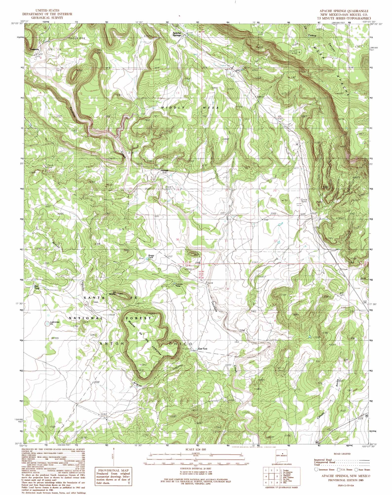
Apache Springs Topo Map New Mexico
To zoom in, hover over the map of Apache Springs
USGS Topo Quad 35105c2 - 1:24,000 scale
| Topo Map Name: | Apache Springs |
| USGS Topo Quad ID: | 35105c2 |
| Print Size: | ca. 21 1/4" wide x 27" high |
| Southeast Coordinates: | 35.25° N latitude / 105.125° W longitude |
| Map Center Coordinates: | 35.3125° N latitude / 105.1875° W longitude |
| U.S. State: | NM |
| Filename: | o35105c2.jpg |
| Download Map JPG Image: | Apache Springs topo map 1:24,000 scale |
| Map Type: | Topographic |
| Topo Series: | 7.5´ |
| Map Scale: | 1:24,000 |
| Source of Map Images: | United States Geological Survey (USGS) |
| Alternate Map Versions: |
Apache Springs NM 2002, updated 2003 Download PDF Buy paper map Apache Springs NM 2011 Download PDF Buy paper map Apache Springs NM 2013 Download PDF Buy paper map Apache Springs NM 2017 Download PDF Buy paper map |
| FStopo: | US Forest Service topo Apache Springs is available: Download FStopo PDF Download FStopo TIF |
1:24,000 Topo Quads surrounding Apache Springs
San Geronimo |
Ojitos Frios |
Las Vegas |
Las Vegas Se |
Laguna La Monia |
San Jose |
Tecolote |
Los Montoyas |
La Liendre |
Mesa Lauriano |
Sena |
Villanueva |
Apache Springs |
Mesa Chupinas |
Chaperito |
Aurora |
San Juan |
Anton Chico |
Dilia |
Pedro Miguel Peak |
Jacinto Mesa |
Potrillo Hill |
Mesa Palo Amarillo |
Thompson Ranch |
Mesita De Guadalupe |
> Back to 35105a1 at 1:100,000 scale
> Back to 35104a1 at 1:250,000 scale
> Back to U.S. Topo Maps home
Apache Springs topo map: Gazetteer
Apache Springs: Mines
Virginia elevation 1716m 5629′Apache Springs: Populated Places
Apache Springs elevation 1816m 5958′Lagunita elevation 1734m 5688′
Apache Springs: Post Offices
Lagunita Post Office (historical) elevation 1734m 5688′Apache Springs: Reservoirs
Boggy Tank elevation 1690m 5544′Calicito Tank elevation 1671m 5482′
East Tank elevation 1659m 5442′
Ladrones Tank elevation 1738m 5702′
Red Tank elevation 1739m 5705′
Apache Springs: Springs
Apache Springs elevation 1816m 5958′Apache Springs: Streams
Arroyo Leguino elevation 1634m 5360′Tres Hermanos Creek elevation 1725m 5659′
Apache Springs: Summits
La Mesita elevation 1780m 5839′Mesita de los Ladrones elevation 1787m 5862′
Middle Mesa elevation 1843m 6046′
Apache Springs: Valleys
Tres Hermanos Cañon elevation 1724m 5656′Apache Springs digital topo map on disk
Buy this Apache Springs topo map showing relief, roads, GPS coordinates and other geographical features, as a high-resolution digital map file on DVD: