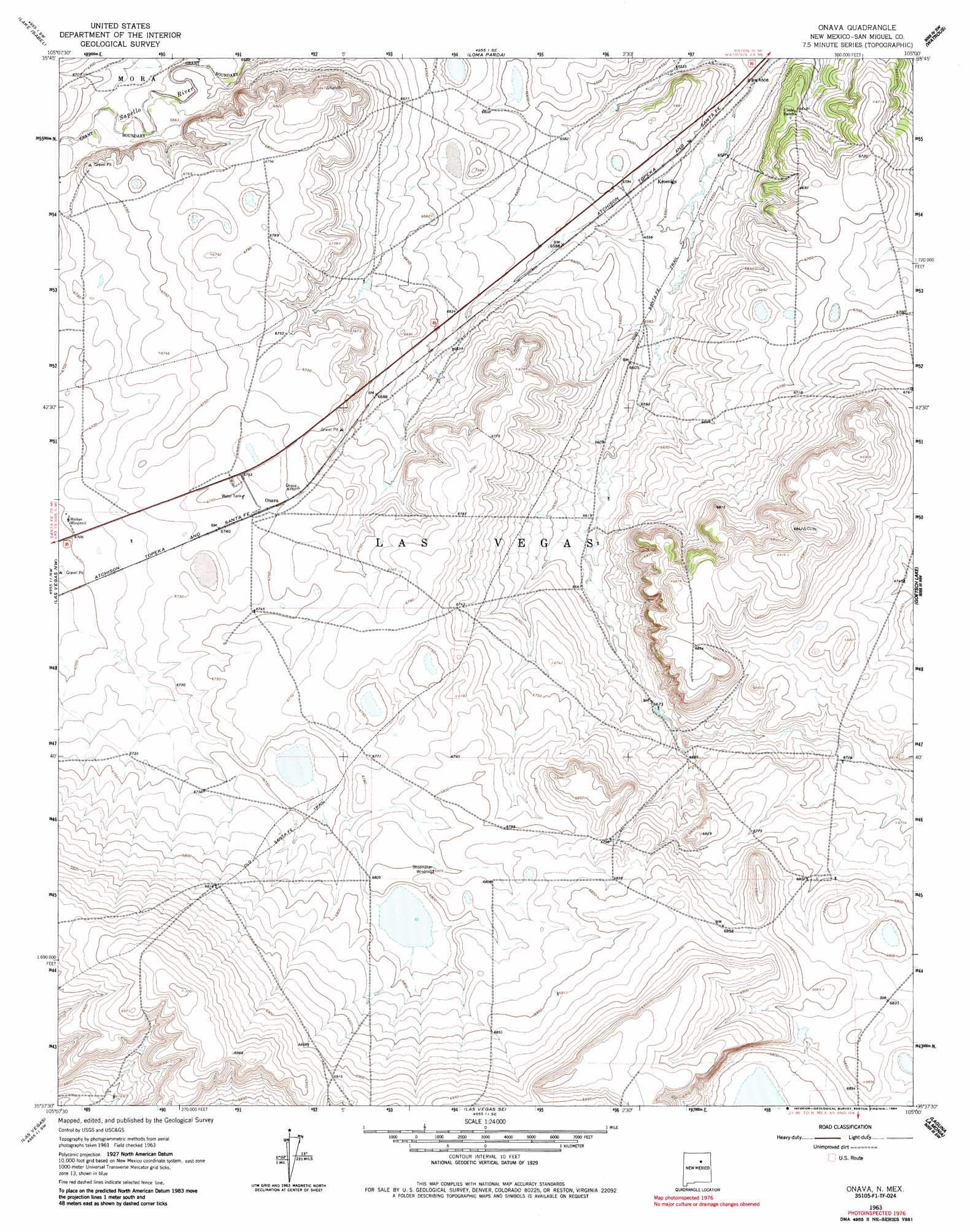
Onava Topo Map New Mexico
To zoom in, hover over the map of Onava
USGS Topo Quad 35105f1 - 1:24,000 scale
| Topo Map Name: | Onava |
| USGS Topo Quad ID: | 35105f1 |
| Print Size: | ca. 21 1/4" wide x 27" high |
| Southeast Coordinates: | 35.625° N latitude / 105° W longitude |
| Map Center Coordinates: | 35.6875° N latitude / 105.0625° W longitude |
| U.S. State: | NM |
| Filename: | o35105f1.jpg |
| Download Map JPG Image: | Onava topo map 1:24,000 scale |
| Map Type: | Topographic |
| Topo Series: | 7.5´ |
| Map Scale: | 1:24,000 |
| Source of Map Images: | United States Geological Survey (USGS) |
| Alternate Map Versions: |
Onava NM 1963, updated 1965 Download PDF Buy paper map Onava NM 1963, updated 1984 Download PDF Buy paper map Onava NM 2010 Download PDF Buy paper map Onava NM 2013 Download PDF Buy paper map Onava NM 2017 Download PDF Buy paper map |
1:24,000 Topo Quads surrounding Onava
Mora |
Rainsville |
Fort Union |
Maxson Crater |
Optimo |
Sapello |
Lake Isabel |
Loma Parda |
Watrous |
Cherry Valley Lake |
Montezuma |
Las Vegas Nw |
Onava |
Goetsch Lake |
Canon Pedroso |
Ojitos Frios |
Las Vegas |
Las Vegas Se |
Laguna La Monia |
Laguna Huerfana |
Tecolote |
Los Montoyas |
La Liendre |
Mesa Lauriano |
Flagstone Mountain |
> Back to 35105e1 at 1:100,000 scale
> Back to 35104a1 at 1:250,000 scale
> Back to U.S. Topo Maps home
Onava topo map: Gazetteer
Onava: Populated Places
Kroenigs elevation 2003m 6571′Onava elevation 2058m 6751′
Onava: Post Offices
Onava Post Office (historical) elevation 2058m 6751′Onava: Trails
Old Santa Fe Trail elevation 2001m 6564′Onava digital topo map on disk
Buy this Onava topo map showing relief, roads, GPS coordinates and other geographical features, as a high-resolution digital map file on DVD: