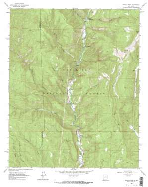
Rosilla Peak Topo Map New Mexico
To zoom in, hover over the map of Rosilla Peak
USGS Topo Quad 35105f6 - 1:24,000 scale
| Topo Map Name: | Rosilla Peak |
| USGS Topo Quad ID: | 35105f6 |
| Print Size: | ca. 21 1/4" wide x 27" high |
| Southeast Coordinates: | 35.625° N latitude / 105.625° W longitude |
| Map Center Coordinates: | 35.6875° N latitude / 105.6875° W longitude |
| U.S. State: | NM |
| Filename: | o35105f6.jpg |
| Download Map JPG Image: | Rosilla Peak topo map 1:24,000 scale |
| Map Type: | Topographic |
| Topo Series: | 7.5´ |
| Map Scale: | 1:24,000 |
| Source of Map Images: | United States Geological Survey (USGS) |
| Alternate Map Versions: |
Rosilla Peak NM 1961, updated 1966 Download PDF Buy paper map Rosilla Peak NM 1961, updated 1973 Download PDF Buy paper map Rosilla Peak NM 1961, updated 1973 Download PDF Buy paper map Rosilla Peak NM 2002, updated 2003 Download PDF Buy paper map Rosilla Peak NM 2011 Download PDF Buy paper map Rosilla Peak NM 2013 Download PDF Buy paper map Rosilla Peak NM 2017 Download PDF Buy paper map |
| FStopo: | US Forest Service topo Rosilla Peak is available: Download FStopo PDF Download FStopo TIF |
1:24,000 Topo Quads surrounding Rosilla Peak
> Back to 35105e1 at 1:100,000 scale
> Back to 35104a1 at 1:250,000 scale
> Back to U.S. Topo Maps home
Rosilla Peak topo map: Gazetteer
Rosilla Peak: Forests
Pecos Ranger District elevation 2653m 8704′Rosilla Peak: Mines
Gould and Thomas Mine elevation 2257m 7404′Jones Mine elevation 2770m 9087′
Rosilla Peak: Parks
Dalton Picnic Area elevation 2199m 7214′Rosilla Peak: Populated Places
El Macho elevation 2229m 7312′Lower La Posada elevation 2200m 7217′
Tererro elevation 2353m 7719′
Tres Lagunas elevation 2307m 7568′
Upper La Posada elevation 2203m 7227′
Rosilla Peak: Springs
Alamosa Spring elevation 2305m 7562′Rosilla Peak: Streams
Davis Creek elevation 2340m 7677′Holy Ghost Creek elevation 2335m 7660′
Indian Creek elevation 2286m 7500′
Rito Chaperito elevation 2554m 8379′
Rito de la Osha elevation 2605m 8546′
Sawyer Creek elevation 2251m 7385′
Rosilla Peak: Summits
Chaperito Knob elevation 3096m 10157′Rosilla Peak elevation 3231m 10600′
Viveash Mesa elevation 3001m 9845′
Rosilla Peak: Valleys
Dalton Canyon elevation 2214m 7263′Dry Gulch elevation 2175m 7135′
Macho Canyon elevation 2240m 7349′
Rosilla Peak digital topo map on disk
Buy this Rosilla Peak topo map showing relief, roads, GPS coordinates and other geographical features, as a high-resolution digital map file on DVD:


