Lake Isabel Topo Map New Mexico
To zoom in, hover over the map of Lake Isabel
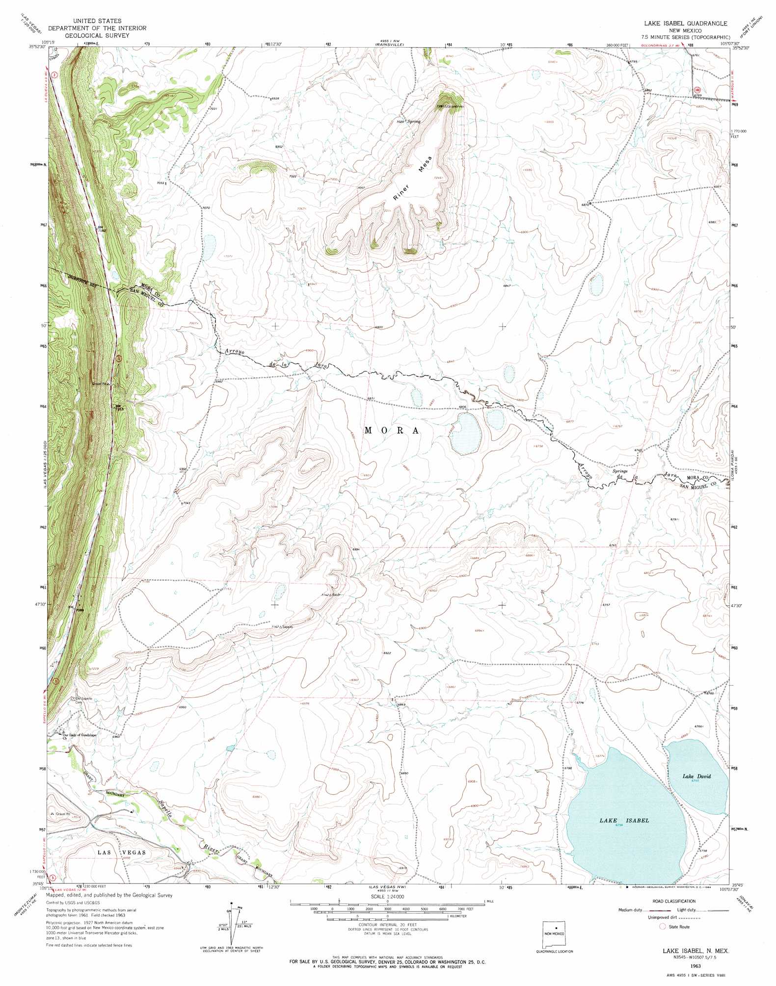
USGS Topo Quad 35105g2 - 1:24,000 scale
| Topo Map Name: | Lake Isabel |
| USGS Topo Quad ID: | 35105g2 |
| Print Size: | ca. 21 1/4" wide x 27" high |
| Southeast Coordinates: | 35.75° N latitude / 105.125° W longitude |
| Map Center Coordinates: | 35.8125° N latitude / 105.1875° W longitude |
| U.S. State: | NM |
| Filename: | o35105g2.jpg |
| Download Map JPG Image: | Lake Isabel topo map 1:24,000 scale |
| Map Type: | Topographic |
| Topo Series: | 7.5´ |
| Map Scale: | 1:24,000 |
| Source of Map Images: | United States Geological Survey (USGS) |
| Alternate Map Versions: |
Lake Isabel NM 1963, updated 1964 Download PDF Buy paper map Lake Isabel NM 2010 Download PDF Buy paper map Lake Isabel NM 2013 Download PDF Buy paper map Lake Isabel NM 2017 Download PDF Buy paper map |
1:24,000 Topo Quads surrounding Lake Isabel
Holman |
Comanche Peak |
Lucero |
Ojo Feliz |
Cerro Negro |
Gascon |
Mora |
Rainsville |
Fort Union |
Maxson Crater |
Rociada |
Sapello |
Lake Isabel |
Loma Parda |
Watrous |
El Porvenir |
Montezuma |
Las Vegas Nw |
Onava |
Goetsch Lake |
San Geronimo |
Ojitos Frios |
Las Vegas |
Las Vegas Se |
Laguna La Monia |
> Back to 35105e1 at 1:100,000 scale
> Back to 35104a1 at 1:250,000 scale
> Back to U.S. Topo Maps home
Lake Isabel topo map: Gazetteer
Lake Isabel: Lakes
Lake David elevation 2057m 6748′Lake Isabel: Summits
Riner Mesa elevation 2222m 7290′Lake Isabel digital topo map on disk
Buy this Lake Isabel topo map showing relief, roads, GPS coordinates and other geographical features, as a high-resolution digital map file on DVD: