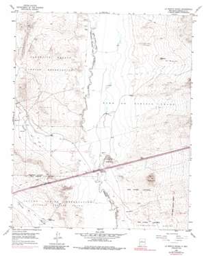
La Mesita Negra Topo Map New Mexico
To zoom in, hover over the map of La Mesita Negra
USGS Topo Quad 35106a8 - 1:24,000 scale
| Topo Map Name: | La Mesita Negra |
| USGS Topo Quad ID: | 35106a8 |
| Print Size: | ca. 21 1/4" wide x 27" high |
| Southeast Coordinates: | 35° N latitude / 106.875° W longitude |
| Map Center Coordinates: | 35.0625° N latitude / 106.9375° W longitude |
| U.S. State: | NM |
| Filename: | o35106a8.jpg |
| Download Map JPG Image: | La Mesita Negra topo map 1:24,000 scale |
| Map Type: | Topographic |
| Topo Series: | 7.5´ |
| Map Scale: | 1:24,000 |
| Source of Map Images: | United States Geological Survey (USGS) |
| Alternate Map Versions: |
La Mesita Negra NM 1954, updated 1955 Download PDF Buy paper map La Mesita Negra NM 1954, updated 1965 Download PDF Buy paper map La Mesita Negra NM 1954, updated 1973 Download PDF Buy paper map La Mesita Negra NM 1954, updated 1986 Download PDF Buy paper map La Mesita Negra NM 1990, updated 1996 Download PDF Buy paper map La Mesita Negra NM 2010 Download PDF Buy paper map La Mesita Negra NM 2013 Download PDF Buy paper map La Mesita Negra NM 2017 Download PDF Buy paper map |
1:24,000 Topo Quads surrounding La Mesita Negra
> Back to 35106a1 at 1:100,000 scale
> Back to 35106a1 at 1:250,000 scale
> Back to U.S. Topo Maps home
La Mesita Negra topo map: Gazetteer
La Mesita Negra: Areas
El Rincon elevation 1703m 5587′La Mesita Negra: Mines
Blackbird Hill elevation 1677m 5501′Cerro Colorado-Archuleta Prospect elevation 1685m 5528′
La Mesita Negra: Populated Places
Fruitvale (historical) elevation 1610m 5282′La Mesita Negra: Streams
Cañada del Ojo elevation 1624m 5328′La Mesita Negra: Summits
Cerro Colorado elevation 1763m 5784′La Mesita Negra elevation 1656m 5433′
La Mesita Negra: Wells
10052 Water Well elevation 1610m 5282′10150 Water Well elevation 1610m 5282′
Cerro Colorado Land Water Well elevation 1664m 5459′
C-T-1 Water Well elevation 1626m 5334′
ECW2 Water Well elevation 1648m 5406′
El Rincon Water Well elevation 1702m 5583′
MW-1 Water Well elevation 1672m 5485′
RWPI Water Well elevation 1628m 5341′
Texaco Water Well elevation 1610m 5282′
La Mesita Negra digital topo map on disk
Buy this La Mesita Negra topo map showing relief, roads, GPS coordinates and other geographical features, as a high-resolution digital map file on DVD:


