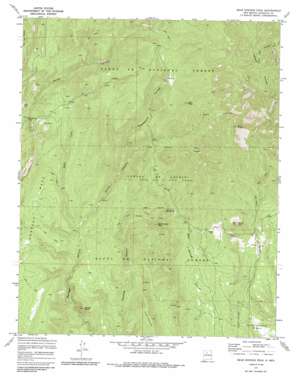
Bear Springs Peak Topo Map New Mexico
To zoom in, hover over the map of Bear Springs Peak
USGS Topo Quad 35106f5 - 1:24,000 scale
| Topo Map Name: | Bear Springs Peak |
| USGS Topo Quad ID: | 35106f5 |
| Print Size: | ca. 21 1/4" wide x 27" high |
| Southeast Coordinates: | 35.625° N latitude / 106.5° W longitude |
| Map Center Coordinates: | 35.6875° N latitude / 106.5625° W longitude |
| U.S. State: | NM |
| Filename: | o35106f5.jpg |
| Download Map JPG Image: | Bear Springs Peak topo map 1:24,000 scale |
| Map Type: | Topographic |
| Topo Series: | 7.5´ |
| Map Scale: | 1:24,000 |
| Source of Map Images: | United States Geological Survey (USGS) |
| Alternate Map Versions: |
Bear Springs Peak NM 1970, updated 1973 Download PDF Buy paper map Bear Springs Peak NM 1970, updated 1985 Download PDF Buy paper map Bear Springs Peak NM 2002, updated 2003 Download PDF Buy paper map Bear Springs Peak NM 2011 Download PDF Buy paper map Bear Springs Peak NM 2013 Download PDF Buy paper map Bear Springs Peak NM 2017 Download PDF Buy paper map |
| FStopo: | US Forest Service topo Bear Springs Peak is available: Download FStopo PDF Download FStopo TIF |
1:24,000 Topo Quads surrounding Bear Springs Peak
> Back to 35106e1 at 1:100,000 scale
> Back to 35106a1 at 1:250,000 scale
> Back to U.S. Topo Maps home
Bear Springs Peak topo map: Gazetteer
Bear Springs Peak: Mines
Canovas Number 13 Group elevation 2238m 7342′Mont de Lion Group elevation 2204m 7230′
Peralta Lion Group elevation 2222m 7290′
Strip Mine elevation 2178m 7145′
Bear Springs Peak: Reservoirs
Chamisal Tank elevation 2218m 7276′Bear Springs Peak: Streams
West Fork Borrego Canyon elevation 2133m 6998′Bear Springs Peak: Summits
Bear Springs Peak elevation 2472m 8110′Borrego Dome elevation 2233m 7326′
Borrego Mesa elevation 2415m 7923′
Cerrito Yelo elevation 2342m 7683′
Cerro la Jara elevation 2711m 8894′
Loma Canovas elevation 2307m 7568′
Ruiz Peak elevation 2778m 9114′
Tres Cerros elevation 2708m 8884′
Bear Springs Peak: Trails
Bland Bear Springs Trail elevation 2257m 7404′Bear Springs Peak: Valleys
Guacamalla Canyon elevation 2242m 7355′Hondo Canyon elevation 2132m 6994′
Bear Springs Peak digital topo map on disk
Buy this Bear Springs Peak topo map showing relief, roads, GPS coordinates and other geographical features, as a high-resolution digital map file on DVD:


