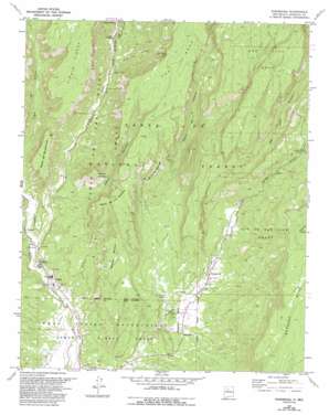
Ponderosa Topo Map New Mexico
To zoom in, hover over the map of Ponderosa
USGS Topo Quad 35106f6 - 1:24,000 scale
| Topo Map Name: | Ponderosa |
| USGS Topo Quad ID: | 35106f6 |
| Print Size: | ca. 21 1/4" wide x 27" high |
| Southeast Coordinates: | 35.625° N latitude / 106.625° W longitude |
| Map Center Coordinates: | 35.6875° N latitude / 106.6875° W longitude |
| U.S. State: | NM |
| Filename: | o35106f6.jpg |
| Download Map JPG Image: | Ponderosa topo map 1:24,000 scale |
| Map Type: | Topographic |
| Topo Series: | 7.5´ |
| Map Scale: | 1:24,000 |
| Source of Map Images: | United States Geological Survey (USGS) |
| Alternate Map Versions: |
Ponderosa NM 1970, updated 1973 Download PDF Buy paper map Ponderosa NM 1970, updated 1993 Download PDF Buy paper map Ponderosa NM 2011 Download PDF Buy paper map Ponderosa NM 2013 Download PDF Buy paper map Ponderosa NM 2017 Download PDF Buy paper map |
| FStopo: | US Forest Service topo Ponderosa is available: Download FStopo PDF Download FStopo TIF |
1:24,000 Topo Quads surrounding Ponderosa
> Back to 35106e1 at 1:100,000 scale
> Back to 35106a1 at 1:250,000 scale
> Back to U.S. Topo Maps home
Ponderosa topo map: Gazetteer
Ponderosa: Airports
Sheraton Inn Heliport elevation 1903m 6243′Ponderosa: Benches
Mesa de los Palomares elevation 2131m 6991′San Juan Mesa elevation 2310m 7578′
Ponderosa: Canals
Cañones Communities Ditch elevation 1740m 5708′Ponderosa: Mines
Pyramid Pumnice Mine elevation 1991m 6532′Spanish Queen Mine elevation 1991m 6532′
Spanish Queen Mine elevation 1871m 6138′
Tex-N Prospect elevation 1997m 6551′
Walsh Pit elevation 2048m 6719′
Ponderosa: Populated Places
Cañon elevation 1734m 5688′Ponderosa elevation 1832m 6010′
Ponderosa: Springs
Las Vegitas Spring elevation 1791m 5875′Ponderosa: Streams
Rio Guadalupe elevation 1726m 5662′Ponderosa: Summits
Mesa de Guadalupe elevation 2125m 6971′Mesa de las Casas elevation 2119m 6952′
Mesa de los Datiles elevation 2116m 6942′
Meseta Blanca elevation 1994m 6541′
Ponderosa: Valleys
Cañon Cercado elevation 1753m 5751′Canon de la Cañada elevation 1854m 6082′
Cañon de San Diego elevation 1730m 5675′
Cañon del Raphael Gallegos elevation 1816m 5958′
Paliza Canyon elevation 1926m 6318′
San Juan Canyon elevation 1832m 6010′
Ponderosa digital topo map on disk
Buy this Ponderosa topo map showing relief, roads, GPS coordinates and other geographical features, as a high-resolution digital map file on DVD:


