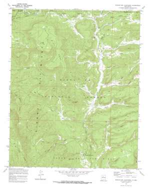
Rancho Del Chaparral Topo Map New Mexico
To zoom in, hover over the map of Rancho Del Chaparral
USGS Topo Quad 35106h7 - 1:24,000 scale
| Topo Map Name: | Rancho Del Chaparral |
| USGS Topo Quad ID: | 35106h7 |
| Print Size: | ca. 21 1/4" wide x 27" high |
| Southeast Coordinates: | 35.875° N latitude / 106.75° W longitude |
| Map Center Coordinates: | 35.9375° N latitude / 106.8125° W longitude |
| U.S. State: | NM |
| Filename: | o35106h7.jpg |
| Download Map JPG Image: | Rancho Del Chaparral topo map 1:24,000 scale |
| Map Type: | Topographic |
| Topo Series: | 7.5´ |
| Map Scale: | 1:24,000 |
| Source of Map Images: | United States Geological Survey (USGS) |
| Alternate Map Versions: |
Rancho Del Chaparral NM 1970, updated 1973 Download PDF Buy paper map Rancho Del Chaparral NM 2002, updated 2003 Download PDF Buy paper map Rancho del Chaparral NM 2011 Download PDF Buy paper map Rancho del Chaparral NM 2013 Download PDF Buy paper map Rancho del Chaparral NM 2017 Download PDF Buy paper map |
| FStopo: | US Forest Service topo Rancho del Chaparral is available: Download FStopo PDF Download FStopo TIF |
1:24,000 Topo Quads surrounding Rancho Del Chaparral
> Back to 35106e1 at 1:100,000 scale
> Back to 35106a1 at 1:250,000 scale
> Back to U.S. Topo Maps home
Rancho Del Chaparral topo map: Gazetteer
Rancho Del Chaparral: Forests
Cuba Ranger District elevation 2535m 8316′Rancho Del Chaparral: Mines
Jewell Prospect elevation 2615m 8579′Rancho Del Chaparral: Populated Places
Deer Lake elevation 2540m 8333′Rancho Del Chaparral: Reservoirs
Deer Lake elevation 2590m 8497′Krause Tank elevation 2438m 7998′
Rancho Del Chaparral: Ridges
Big Mountain elevation 2815m 9235′Rancho Del Chaparral: Springs
Barley Spring elevation 2462m 8077′Redtop Spring elevation 2463m 8080′
Turkey Spring elevation 2469m 8100′
Vacus Spring elevation 2479m 8133′
Rancho Del Chaparral: Streams
American Creek elevation 2483m 8146′Clear Creek elevation 2488m 8162′
Rito de las Palomas elevation 2471m 8106′
Rito del Indio elevation 2357m 7732′
Rito Peñas Negras elevation 2433m 7982′
Rock Creek elevation 2456m 8057′
Trail Creek elevation 2377m 7798′
Turkey Creek elevation 2396m 7860′
Rancho Del Chaparral: Summits
Blue Bird Mesa elevation 2832m 9291′Rock Creek Mesa elevation 2576m 8451′
Smokey Bear Hill elevation 2699m 8854′
Rancho Del Chaparral: Valleys
Barley Canyon elevation 2417m 7929′Burned Canyon elevation 2455m 8054′
Horse Canyon elevation 2422m 7946′
Middle Fork Ojitos Canyon elevation 2445m 8021′
Moon Canyon elevation 2436m 7992′
North Fork Ojitos Canyon elevation 2444m 8018′
Ojitos Canyon elevation 2310m 7578′
Road Canyon elevation 2436m 7992′
School Section Canyon elevation 2388m 7834′
South Fork Ojitos Canyon elevation 2401m 7877′
Telephone Canyon elevation 2398m 7867′
Windy Canyon elevation 2522m 8274′
Wolf Canyon elevation 2422m 7946′
Rancho Del Chaparral digital topo map on disk
Buy this Rancho Del Chaparral topo map showing relief, roads, GPS coordinates and other geographical features, as a high-resolution digital map file on DVD:


