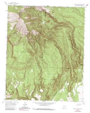
Mount Taylor Topo Map New Mexico
To zoom in, hover over the map of Mount Taylor
USGS Topo Quad 35107b5 - 1:24,000 scale
| Topo Map Name: | Mount Taylor |
| USGS Topo Quad ID: | 35107b5 |
| Print Size: | ca. 21 1/4" wide x 27" high |
| Southeast Coordinates: | 35.125° N latitude / 107.5° W longitude |
| Map Center Coordinates: | 35.1875° N latitude / 107.5625° W longitude |
| U.S. State: | NM |
| Filename: | o35107b5.jpg |
| Download Map JPG Image: | Mount Taylor topo map 1:24,000 scale |
| Map Type: | Topographic |
| Topo Series: | 7.5´ |
| Map Scale: | 1:24,000 |
| Source of Map Images: | United States Geological Survey (USGS) |
| Alternate Map Versions: |
Mount Taylor NM 1957, updated 1959 Download PDF Buy paper map Mount Taylor NM 1957, updated 1967 Download PDF Buy paper map Mount Taylor NM 1957, updated 1986 Download PDF Buy paper map Mount Taylor NM 1995, updated 1998 Download PDF Buy paper map Mount Taylor NM 2011 Download PDF Buy paper map Mount Taylor NM 2013 Download PDF Buy paper map |
| FStopo: | US Forest Service topo Mount Taylor is available: Download FStopo PDF Download FStopo TIF |
1:24,000 Topo Quads surrounding Mount Taylor
> Back to 35107a1 at 1:100,000 scale
> Back to 35106a1 at 1:250,000 scale
> Back to U.S. Topo Maps home
Mount Taylor topo map: Gazetteer
Mount Taylor: Mines
Mount Taylor Mine elevation 2795m 9169′Mount Taylor: Parks
Mount Taylor Historical Marker elevation 3445m 11302′Mount Taylor: Springs
Bosque Spring elevation 2962m 9717′Cañovitas Spring elevation 2909m 9543′
Cliff Spring elevation 2265m 7431′
De Armand Spring elevation 2495m 8185′
Gooseberry Spring elevation 2983m 9786′
Raton Spring elevation 2390m 7841′
Seco Spring elevation 2441m 8008′
Trough Spring elevation 2813m 9229′
Mount Taylor: Summits
Mount Taylor elevation 3445m 11302′Mount Taylor: Valleys
Castillo Canyon elevation 2009m 6591′Timber Canyon elevation 2041m 6696′
Water Canyon elevation 2066m 6778′
Mount Taylor: Wells
Castillo One Water Well elevation 2049m 6722′Mount Taylor digital topo map on disk
Buy this Mount Taylor topo map showing relief, roads, GPS coordinates and other geographical features, as a high-resolution digital map file on DVD:


