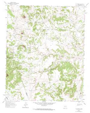
La Gotera Topo Map New Mexico
To zoom in, hover over the map of La Gotera
USGS Topo Quad 35107c2 - 1:24,000 scale
| Topo Map Name: | La Gotera |
| USGS Topo Quad ID: | 35107c2 |
| Print Size: | ca. 21 1/4" wide x 27" high |
| Southeast Coordinates: | 35.25° N latitude / 107.125° W longitude |
| Map Center Coordinates: | 35.3125° N latitude / 107.1875° W longitude |
| U.S. State: | NM |
| Filename: | o35107c2.jpg |
| Download Map JPG Image: | La Gotera topo map 1:24,000 scale |
| Map Type: | Topographic |
| Topo Series: | 7.5´ |
| Map Scale: | 1:24,000 |
| Source of Map Images: | United States Geological Survey (USGS) |
| Alternate Map Versions: |
La Gotera NM 1961, updated 1963 Download PDF Buy paper map La Gotera NM 1961, updated 1974 Download PDF Buy paper map La Gotera NM 2010 Download PDF Buy paper map La Gotera NM 2013 Download PDF Buy paper map |
1:24,000 Topo Quads surrounding La Gotera
> Back to 35107a1 at 1:100,000 scale
> Back to 35106a1 at 1:250,000 scale
> Back to U.S. Topo Maps home
La Gotera topo map: Gazetteer
La Gotera: Mines
B and G Prospect elevation 1980m 6496′Betty Mine elevation 1946m 6384′
Brookhaven Prospect elevation 1950m 6397′
Dorey Mine elevation 1916m 6286′
La Gotera: Populated Places
Dos Tristes elevation 2000m 6561′La Gotera elevation 1872m 6141′
La Gotera: Springs
Ojo De Santa Rosa elevation 1953m 6407′Pino Spring elevation 1882m 6174′
La Gotera: Streams
Cañada Salada elevation 1879m 6164′La Gotera: Summits
Cerro Chato elevation 2097m 6879′Cerro de Jacobo elevation 2226m 7303′
Cerro de Santa Rosa elevation 2171m 7122′
Mesa Cocina elevation 2009m 6591′
Mesita de la Madera elevation 2350m 7709′
La Gotera: Valleys
Canon de la Agua Blanca elevation 1906m 6253′Cañon del Piojo elevation 1818m 5964′
East Cañon de Santa Rosa elevation 1912m 6272′
San Antonio Valley elevation 1987m 6519′
La Gotera: Wells
Agua Blanca Well elevation 1910m 6266′Dogs Water Well elevation 2001m 6564′
San Antonio Water Well elevation 2039m 6689′
La Gotera digital topo map on disk
Buy this La Gotera topo map showing relief, roads, GPS coordinates and other geographical features, as a high-resolution digital map file on DVD:


