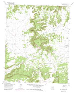
Goat Mountain Topo Map New Mexico
To zoom in, hover over the map of Goat Mountain
USGS Topo Quad 35107d8 - 1:24,000 scale
| Topo Map Name: | Goat Mountain |
| USGS Topo Quad ID: | 35107d8 |
| Print Size: | ca. 21 1/4" wide x 27" high |
| Southeast Coordinates: | 35.375° N latitude / 107.875° W longitude |
| Map Center Coordinates: | 35.4375° N latitude / 107.9375° W longitude |
| U.S. State: | NM |
| Filename: | o35107d8.jpg |
| Download Map JPG Image: | Goat Mountain topo map 1:24,000 scale |
| Map Type: | Topographic |
| Topo Series: | 7.5´ |
| Map Scale: | 1:24,000 |
| Source of Map Images: | United States Geological Survey (USGS) |
| Alternate Map Versions: |
Goat Mountain NM 1957, updated 1959 Download PDF Buy paper map Goat Mountain NM 1957, updated 1968 Download PDF Buy paper map Goat Mountain NM 1957, updated 1981 Download PDF Buy paper map Goat Mountain NM 2010 Download PDF Buy paper map Goat Mountain NM 2013 Download PDF Buy paper map |
1:24,000 Topo Quads surrounding Goat Mountain
> Back to 35107a1 at 1:100,000 scale
> Back to 35106a1 at 1:250,000 scale
> Back to U.S. Topo Maps home
Goat Mountain topo map: Gazetteer
Goat Mountain: Capes
Lassa Point elevation 2355m 7726′Goat Mountain: Mines
Dakota Mine elevation 2175m 7135′Febco Tunnel Number 1 elevation 2213m 7260′
Homestake-Sapin Mine Number 15 elevation 2161m 7089′
Junior Mine elevation 2217m 7273′
Kermac Mine Number 22 elevation 2160m 7086′
Kermac Number 10 Mine elevation 2170m 7119′
Martinez Mine elevation 2174m 7132′
Nite Group elevation 2142m 7027′
Silver Spur Mine elevation 2197m 7208′
Goat Mountain: Ridges
Goat Mountain elevation 2299m 7542′Goat Mountain: Summits
Little Haystack Mountain elevation 2391m 7844′Mesa Redonda elevation 2440m 8005′
Pistol Butte elevation 2275m 7463′
Two Fault Butte elevation 2266m 7434′
Goat Mountain: Wells
Kerr-Mac Water Well elevation 2143m 7030′Goat Mountain digital topo map on disk
Buy this Goat Mountain topo map showing relief, roads, GPS coordinates and other geographical features, as a high-resolution digital map file on DVD:


