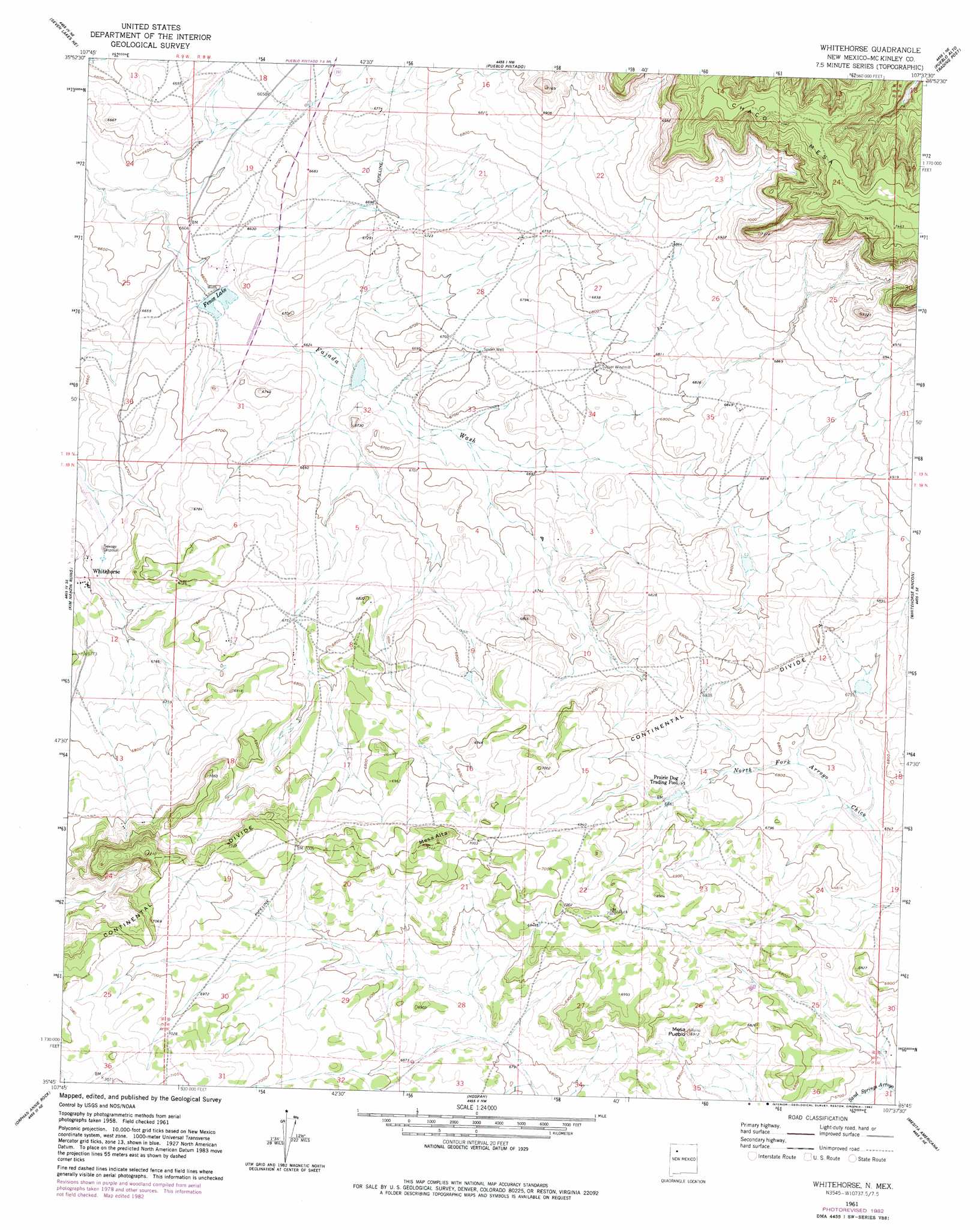
Whitehorse Topo Map New Mexico
To zoom in, hover over the map of Whitehorse
USGS Topo Quad 35107g6 - 1:24,000 scale
| Topo Map Name: | Whitehorse |
| USGS Topo Quad ID: | 35107g6 |
| Print Size: | ca. 21 1/4" wide x 27" high |
| Southeast Coordinates: | 35.75° N latitude / 107.625° W longitude |
| Map Center Coordinates: | 35.8125° N latitude / 107.6875° W longitude |
| U.S. State: | NM |
| Filename: | o35107g6.jpg |
| Download Map JPG Image: | Whitehorse topo map 1:24,000 scale |
| Map Type: | Topographic |
| Topo Series: | 7.5´ |
| Map Scale: | 1:24,000 |
| Source of Map Images: | United States Geological Survey (USGS) |
| Alternate Map Versions: |
Whitehorse NM 1961, updated 1963 Download PDF Buy paper map Whitehorse NM 1961, updated 1982 Download PDF Buy paper map Whitehorse NM 2010 Download PDF Buy paper map Whitehorse NM 2013 Download PDF Buy paper map Whitehorse NM 2017 Download PDF Buy paper map |
1:24,000 Topo Quads surrounding Whitehorse
Pueblo Bonito |
Sargent Ranch |
Fire Rock Well |
Lybrook Se |
Mule Dam |
Seven Lakes Nw |
Seven Lakes Ne |
Pueblo Pintado |
Pueblo Alto Trading Post |
Star Lake |
Seven Lakes |
Seven Lakes Se |
Whitehorse |
Whitehorse Rincon |
Rincon Marquez |
Laguna Castillo |
Orphan Annie Rock |
Hospah |
Mesita Americana |
Mesita Del Gavilan |
Borrego Pass |
Mesa De Los Toros |
Piedra De La Aguila |
El Dado |
Mesa Cortada |
> Back to 35107e1 at 1:100,000 scale
> Back to 35106a1 at 1:250,000 scale
> Back to U.S. Topo Maps home
Whitehorse topo map: Gazetteer
Whitehorse: Populated Places
Whitehorse elevation 2040m 6692′Whitehorse: Reservoirs
Fence Lake elevation 2013m 6604′Whitehorse: Summits
Mesa Alta elevation 2157m 7076′Mesa Pueblo elevation 2098m 6883′
Whitehorse: Wells
Chavez Water Well elevation 2071m 6794′Chee Water Well elevation 2049m 6722′
Tucker Water Well elevation 2075m 6807′
Whitehorse Water Well elevation 2044m 6706′
Whitehorse digital topo map on disk
Buy this Whitehorse topo map showing relief, roads, GPS coordinates and other geographical features, as a high-resolution digital map file on DVD: