Horsehead Canyon Topo Map New Mexico
To zoom in, hover over the map of Horsehead Canyon
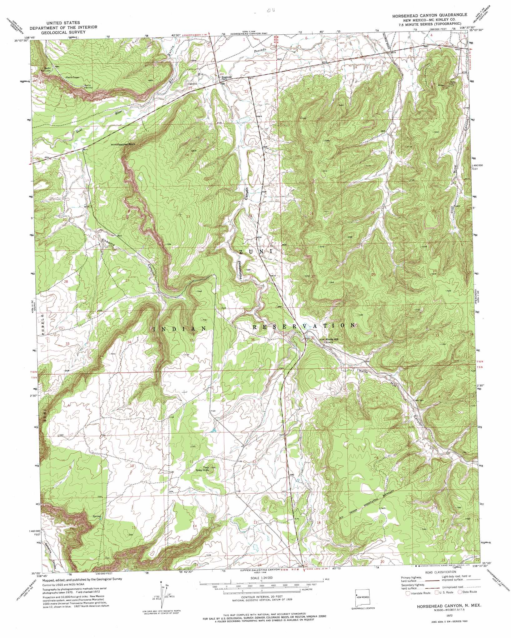
USGS Topo Quad 35108a6 - 1:24,000 scale
| Topo Map Name: | Horsehead Canyon |
| USGS Topo Quad ID: | 35108a6 |
| Print Size: | ca. 21 1/4" wide x 27" high |
| Southeast Coordinates: | 35° N latitude / 108.625° W longitude |
| Map Center Coordinates: | 35.0625° N latitude / 108.6875° W longitude |
| U.S. State: | NM |
| Filename: | o35108a6.jpg |
| Download Map JPG Image: | Horsehead Canyon topo map 1:24,000 scale |
| Map Type: | Topographic |
| Topo Series: | 7.5´ |
| Map Scale: | 1:24,000 |
| Source of Map Images: | United States Geological Survey (USGS) |
| Alternate Map Versions: |
Horsehead Canyon NM 1972, updated 1976 Download PDF Buy paper map Horsehead Canyon NM 2010 Download PDF Buy paper map Horsehead Canyon NM 2013 Download PDF Buy paper map Horsehead Canyon NM 2017 Download PDF Buy paper map |
1:24,000 Topo Quads surrounding Horsehead Canyon
Jones Ranch School |
Vander Wagen |
Pinehaven |
Upper Nutria |
Page |
Chi Chil Tah |
Vanderwagen Draw |
Horsehead Canyon Nw |
Burned Timber Canyon |
Ramah |
Tekapo |
Zuni |
Horsehead Canyon |
Pescado |
Togeye Lake |
Ojo Caliente Reservoir |
Plumasano Basin |
Upper Galestina Canyon |
Shoemaker Canyon |
Nicoll Lake |
Venadito Camp |
Atarque Lake |
Mesita De Yeso |
Shoemaker Canyon Se |
Red Lake Mission |
> Back to 35108a1 at 1:100,000 scale
> Back to 35108a1 at 1:250,000 scale
> Back to U.S. Topo Maps home
Horsehead Canyon topo map: Gazetteer
Horsehead Canyon: Arches
Pierced Rock elevation 2049m 6722′Horsehead Canyon: Streams
Rio Nutria elevation 1989m 6525′Rio Pescado elevation 1988m 6522′
Horsehead Canyon: Summits
Feather Rock elevation 2007m 6584′Knife Hill elevation 2128m 6981′
Two Grey Hills elevation 2209m 7247′
Horsehead Canyon: Valleys
Chama Canyon elevation 2012m 6601′Cheama Canyon elevation 1982m 6502′
Horsehead Canyon elevation 2009m 6591′
Knife Hill Canyon elevation 2094m 6870′
Horsehead Canyon digital topo map on disk
Buy this Horsehead Canyon topo map showing relief, roads, GPS coordinates and other geographical features, as a high-resolution digital map file on DVD: