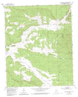
Post Office Flat Topo Map New Mexico
To zoom in, hover over the map of Post Office Flat
USGS Topo Quad 35108b2 - 1:24,000 scale
| Topo Map Name: | Post Office Flat |
| USGS Topo Quad ID: | 35108b2 |
| Print Size: | ca. 21 1/4" wide x 27" high |
| Southeast Coordinates: | 35.125° N latitude / 108.125° W longitude |
| Map Center Coordinates: | 35.1875° N latitude / 108.1875° W longitude |
| U.S. State: | NM |
| Filename: | o35108b2.jpg |
| Download Map JPG Image: | Post Office Flat topo map 1:24,000 scale |
| Map Type: | Topographic |
| Topo Series: | 7.5´ |
| Map Scale: | 1:24,000 |
| Source of Map Images: | United States Geological Survey (USGS) |
| Alternate Map Versions: |
Post Office Flat NM 1952, updated 1953 Download PDF Buy paper map Post Office Flat NM 1952, updated 1971 Download PDF Buy paper map Post Office Flat NM 1952, updated 1981 Download PDF Buy paper map Post Office Flat NM 1995, updated 1997 Download PDF Buy paper map Post Office Flat NM 2011 Download PDF Buy paper map Post Office Flat NM 2013 Download PDF Buy paper map Post Office Flat NM 2017 Download PDF Buy paper map |
| FStopo: | US Forest Service topo Post Office Flat is available: Download FStopo PDF Download FStopo TIF |
1:24,000 Topo Quads surrounding Post Office Flat
> Back to 35108a1 at 1:100,000 scale
> Back to 35108a1 at 1:250,000 scale
> Back to U.S. Topo Maps home
Post Office Flat topo map: Gazetteer
Post Office Flat: Flats
Post Office Flat elevation 2591m 8500′Post Office Flat: Lakes
Agua Media elevation 2462m 8077′Post Office Flat: Mines
Mirabal Mine elevation 2467m 8093′Post Office Flat: Populated Places
Copperton elevation 2544m 8346′Diener elevation 2566m 8418′
Sawyer elevation 2421m 7942′
Post Office Flat: Post Offices
Coppertown Post Office (historical) elevation 2544m 8346′Diener Post Office (historical) elevation 2566m 8418′
Sawyer Post Office (historical) elevation 2421m 7942′
Post Office Flat: Springs
Ojitos elevation 2478m 8129′Post Office Flat Spring elevation 2580m 8464′
Rock Spring elevation 2486m 8156′
Serna Spring elevation 2455m 8054′
Post Office Flat: Valleys
Copperton Canyon elevation 2465m 8087′Diener Canyon elevation 2367m 7765′
Ojo Redondo Canyon elevation 2339m 7673′
Post Office Flat digital topo map on disk
Buy this Post Office Flat topo map showing relief, roads, GPS coordinates and other geographical features, as a high-resolution digital map file on DVD:


