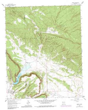
Ramah Topo Map New Mexico
To zoom in, hover over the map of Ramah
USGS Topo Quad 35108b4 - 1:24,000 scale
| Topo Map Name: | Ramah |
| USGS Topo Quad ID: | 35108b4 |
| Print Size: | ca. 21 1/4" wide x 27" high |
| Southeast Coordinates: | 35.125° N latitude / 108.375° W longitude |
| Map Center Coordinates: | 35.1875° N latitude / 108.4375° W longitude |
| U.S. State: | NM |
| Filename: | o35108b4.jpg |
| Download Map JPG Image: | Ramah topo map 1:24,000 scale |
| Map Type: | Topographic |
| Topo Series: | 7.5´ |
| Map Scale: | 1:24,000 |
| Source of Map Images: | United States Geological Survey (USGS) |
| Alternate Map Versions: |
Ramah NM 1963, updated 1965 Download PDF Buy paper map Ramah NM 1963, updated 1981 Download PDF Buy paper map Ramah NM 1995, updated 1997 Download PDF Buy paper map Ramah NM 2011 Download PDF Buy paper map Ramah NM 2013 Download PDF Buy paper map Ramah NM 2017 Download PDF Buy paper map |
| FStopo: | US Forest Service topo Ramah is available: Download FStopo PDF Download FStopo TIF |
1:24,000 Topo Quads surrounding Ramah
> Back to 35108a1 at 1:100,000 scale
> Back to 35108a1 at 1:250,000 scale
> Back to U.S. Topo Maps home
Ramah topo map: Gazetteer
Ramah: Airports
Ramah Lake Airstrip elevation 2123m 6965′Ramah: Dams
Ramah Reservoir Dam elevation 2113m 6932′Ramah: Falls
The Falls elevation 2231m 7319′Ramah: Populated Places
Ramah elevation 2112m 6929′Ramah: Post Offices
Ramah Post Office elevation 2112m 6929′Ramah: Reservoirs
Ramah Reservoir elevation 2116m 6942′Ramah: Springs
Dan Valley Spring elevation 2321m 7614′Ramah: Summits
Wild Sheep Mesa elevation 2295m 7529′Ramah: Valleys
Burnt Mill Canyon elevation 2127m 6978′Coal Hollow elevation 2114m 6935′
Dan Valley elevation 2302m 7552′
Harris Valley elevation 2292m 7519′
Oak Hollow elevation 2160m 7086′
Pasture Hollow elevation 2116m 6942′
Pipkin Canyon elevation 2181m 7155′
Togeye Canyon elevation 2116m 6942′
Ramah: Wells
Dent Ranch Water Well elevation 2126m 6975′Ramah digital topo map on disk
Buy this Ramah topo map showing relief, roads, GPS coordinates and other geographical features, as a high-resolution digital map file on DVD:


