Vanderwagen Draw Topo Map New Mexico
To zoom in, hover over the map of Vanderwagen Draw
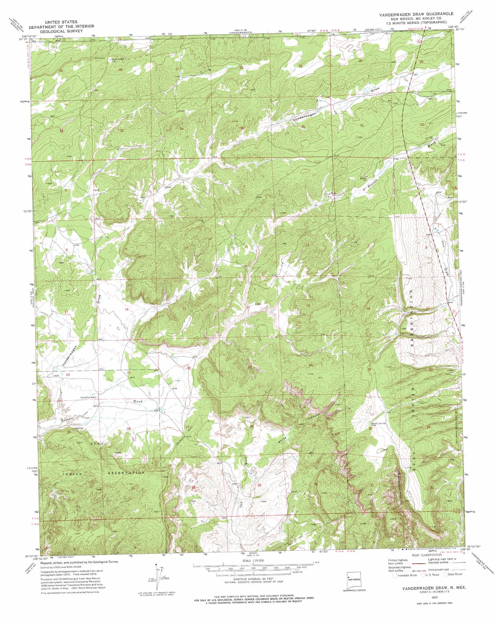
USGS Topo Quad 35108b7 - 1:24,000 scale
| Topo Map Name: | Vanderwagen Draw |
| USGS Topo Quad ID: | 35108b7 |
| Print Size: | ca. 21 1/4" wide x 27" high |
| Southeast Coordinates: | 35.125° N latitude / 108.75° W longitude |
| Map Center Coordinates: | 35.1875° N latitude / 108.8125° W longitude |
| U.S. State: | NM |
| Filename: | o35108b7.jpg |
| Download Map JPG Image: | Vanderwagen Draw topo map 1:24,000 scale |
| Map Type: | Topographic |
| Topo Series: | 7.5´ |
| Map Scale: | 1:24,000 |
| Source of Map Images: | United States Geological Survey (USGS) |
| Alternate Map Versions: |
Vanderwagen Draw NM 1972, updated 1976 Download PDF Buy paper map Vanderwagen Draw NM 2010 Download PDF Buy paper map Vanderwagen Draw NM 2013 Download PDF Buy paper map |
1:24,000 Topo Quads surrounding Vanderwagen Draw
Surrender Canyon |
Manuelito |
Twin Buttes |
Bread Springs |
Fort Wingate |
Lupton |
Jones Ranch School |
Vander Wagen |
Pinehaven |
Upper Nutria |
Chafin Well |
Chi Chil Tah |
Vanderwagen Draw |
Horsehead Canyon Nw |
Burned Timber Canyon |
High Lonesome Well |
Tekapo |
Zuni |
Horsehead Canyon |
Pescado |
Barth Well |
Ojo Caliente Reservoir |
Plumasano Basin |
Upper Galestina Canyon |
Shoemaker Canyon |
> Back to 35108a1 at 1:100,000 scale
> Back to 35108a1 at 1:250,000 scale
> Back to U.S. Topo Maps home
Vanderwagen Draw topo map: Gazetteer
Vanderwagen Draw: Summits
Dubois Hill elevation 2056m 6745′Vanderwagen Draw: Valleys
Vanderwagen Draw elevation 2006m 6581′White Canyon elevation 2009m 6591′
Vanderwagen Draw: Wells
Gonzales Well elevation 2019m 6624′Vanderwagen Draw digital topo map on disk
Buy this Vanderwagen Draw topo map showing relief, roads, GPS coordinates and other geographical features, as a high-resolution digital map file on DVD: