Chi Chil Tah Topo Map New Mexico
To zoom in, hover over the map of Chi Chil Tah
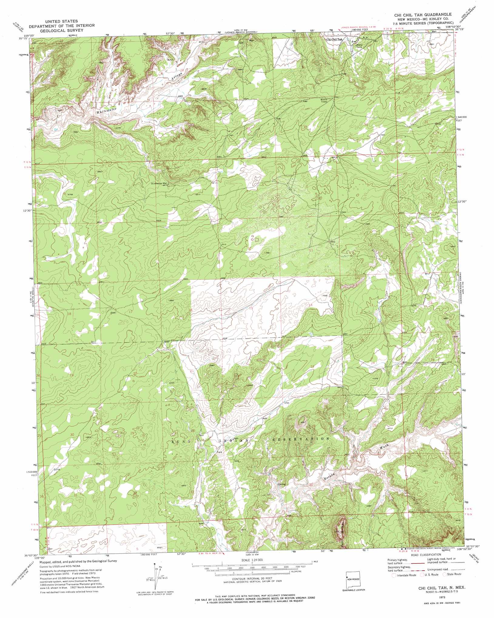
USGS Topo Quad 35108b8 - 1:24,000 scale
| Topo Map Name: | Chi Chil Tah |
| USGS Topo Quad ID: | 35108b8 |
| Print Size: | ca. 21 1/4" wide x 27" high |
| Southeast Coordinates: | 35.125° N latitude / 108.875° W longitude |
| Map Center Coordinates: | 35.1875° N latitude / 108.9375° W longitude |
| U.S. State: | NM |
| Filename: | o35108b8.jpg |
| Download Map JPG Image: | Chi Chil Tah topo map 1:24,000 scale |
| Map Type: | Topographic |
| Topo Series: | 7.5´ |
| Map Scale: | 1:24,000 |
| Source of Map Images: | United States Geological Survey (USGS) |
| Alternate Map Versions: |
Chi Chil Tah NM 1973, updated 1976 Download PDF Buy paper map Chi Chil Tah NM 2010 Download PDF Buy paper map Chi Chil Tah NM 2013 Download PDF Buy paper map Chi Chil Tah NM 2017 Download PDF Buy paper map |
1:24,000 Topo Quads surrounding Chi Chil Tah
Uranium Spring |
Surrender Canyon |
Manuelito |
Twin Buttes |
Bread Springs |
Houck |
Lupton |
Jones Ranch School |
Vander Wagen |
Pinehaven |
Tolapai Spring |
Chafin Well |
Chi Chil Tah |
Vanderwagen Draw |
Horsehead Canyon Nw |
Deep Lake |
High Lonesome Well |
Tekapo |
Zuni |
Horsehead Canyon |
Wild Cow Lake |
Barth Well |
Ojo Caliente Reservoir |
Plumasano Basin |
Upper Galestina Canyon |
> Back to 35108a1 at 1:100,000 scale
> Back to 35108a1 at 1:250,000 scale
> Back to U.S. Topo Maps home
Chi Chil Tah digital topo map on disk
Buy this Chi Chil Tah topo map showing relief, roads, GPS coordinates and other geographical features, as a high-resolution digital map file on DVD: