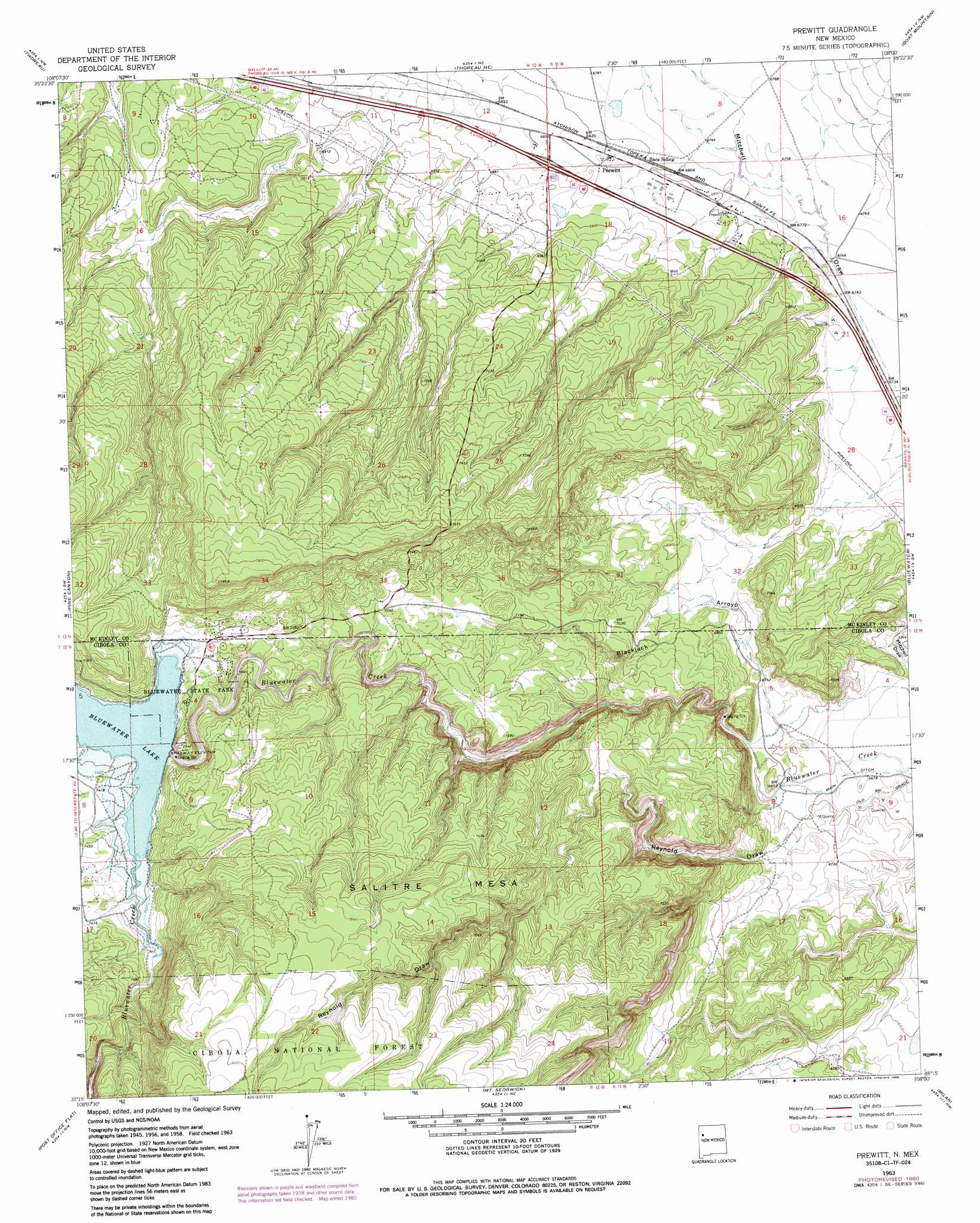
Prewitt Topo Map New Mexico
To zoom in, hover over the map of Prewitt
USGS Topo Quad 35108c1 - 1:24,000 scale
| Topo Map Name: | Prewitt |
| USGS Topo Quad ID: | 35108c1 |
| Print Size: | ca. 21 1/4" wide x 27" high |
| Southeast Coordinates: | 35.25° N latitude / 108° W longitude |
| Map Center Coordinates: | 35.3125° N latitude / 108.0625° W longitude |
| U.S. State: | NM |
| Filename: | o35108c1.jpg |
| Download Map JPG Image: | Prewitt topo map 1:24,000 scale |
| Map Type: | Topographic |
| Topo Series: | 7.5´ |
| Map Scale: | 1:24,000 |
| Source of Map Images: | United States Geological Survey (USGS) |
| Alternate Map Versions: |
Prewitt NM 1963, updated 1966 Download PDF Buy paper map Prewitt NM 1963, updated 1981 Download PDF Buy paper map Prewitt NM 1963, updated 1986 Download PDF Buy paper map Prewitt NM 1995, updated 1998 Download PDF Buy paper map Prewitt NM 2011 Download PDF Buy paper map Prewitt NM 2013 Download PDF Buy paper map |
| FStopo: | US Forest Service topo Prewitt is available: Download FStopo PDF Download FStopo TIF |
1:24,000 Topo Quads surrounding Prewitt
Mariano Lake |
Hosta Butte |
Casamero Lake |
Borrego Pass |
Mesa De Los Toros |
Continental Divide |
Thoreau |
Thoreau Ne |
Goat Mountain |
Ambrosia Lake |
Cottonwood Canyon |
Pine Canyon |
Prewitt |
Bluewater |
Dos Lomas |
Kettner Canyon |
Post Office Flat |
Mount Sedgwick |
Milan |
Grants |
El Morro |
Valle Largo |
Paxton Springs |
San Rafael |
Grants Se |
> Back to 35108a1 at 1:100,000 scale
> Back to 35108a1 at 1:250,000 scale
> Back to U.S. Topo Maps home
Prewitt topo map: Gazetteer
Prewitt: Arroyos
Blackjack Arroyo elevation 2031m 6663′Prewitt: Dams
Bluewater Dam elevation 2238m 7342′Prewitt: Mines
Williams Property elevation 2130m 6988′Prewitt: Parks
Bluewater Lake State Park elevation 2270m 7447′Prewitt: Populated Places
Prewitt elevation 2081m 6827′Prewitt: Post Offices
Prewitt Post Office elevation 2074m 6804′Prewitt: Reservoirs
Bluewater Lake elevation 2238m 7342′Prewitt: Valleys
Las Tusas Valley elevation 2250m 7381′Reynold Draw elevation 2036m 6679′
Prewitt: Wells
10083 Water Well elevation 2049m 6722′Baca Number 6 Water Well elevation 2077m 6814′
Prewitt digital topo map on disk
Buy this Prewitt topo map showing relief, roads, GPS coordinates and other geographical features, as a high-resolution digital map file on DVD: