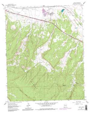
Ciniza Topo Map New Mexico
To zoom in, hover over the map of Ciniza
USGS Topo Quad 35108d4 - 1:24,000 scale
| Topo Map Name: | Ciniza |
| USGS Topo Quad ID: | 35108d4 |
| Print Size: | ca. 21 1/4" wide x 27" high |
| Southeast Coordinates: | 35.375° N latitude / 108.375° W longitude |
| Map Center Coordinates: | 35.4375° N latitude / 108.4375° W longitude |
| U.S. State: | NM |
| Filename: | o35108d4.jpg |
| Download Map JPG Image: | Ciniza topo map 1:24,000 scale |
| Map Type: | Topographic |
| Topo Series: | 7.5´ |
| Map Scale: | 1:24,000 |
| Source of Map Images: | United States Geological Survey (USGS) |
| Alternate Map Versions: |
Ciniza NM 1962, updated 1966 Download PDF Buy paper map Ciniza NM 1962, updated 1981 Download PDF Buy paper map Ciniza NM 1962, updated 1981 Download PDF Buy paper map Ciniza NM 1995, updated 1998 Download PDF Buy paper map Ciniza NM 2011 Download PDF Buy paper map Ciniza NM 2013 Download PDF Buy paper map Ciniza NM 2017 Download PDF Buy paper map |
| FStopo: | US Forest Service topo Ciniza is available: Download FStopo PDF Download FStopo TIF |
1:24,000 Topo Quads surrounding Ciniza
> Back to 35108a1 at 1:100,000 scale
> Back to 35108a1 at 1:250,000 scale
> Back to U.S. Topo Maps home
Ciniza topo map: Gazetteer
Ciniza: Crossings
Iyanbito Interchange elevation 2083m 6833′Refinery Interchange elevation 2116m 6942′
Ciniza: Mines
Foster Canyon Group elevation 2292m 7519′Grenko Mine elevation 2242m 7355′
Ciniza: Populated Places
Ciniza elevation 2114m 6935′South Guam elevation 2135m 7004′
Ciniza: Post Offices
Perea Post Office (historical) elevation 2088m 6850′Ciniza: Reservoirs
Brushy Two Tank elevation 2499m 8198′Brushy-One Tank elevation 2500m 8202′
Deer Stock Tank elevation 2461m 8074′
North Tank elevation 2440m 8005′
Section Six Tank elevation 2513m 8244′
Windmill Tank elevation 2425m 7956′
Yellow Stock Tank elevation 2405m 7890′
Ciniza: Springs
Sixmile Spring elevation 2233m 7326′Ciniza: Streams
Willow Creek elevation 2339m 7673′Ciniza: Summits
Barometer Mountain elevation 2451m 8041′Ciniza: Valleys
Fourmile Canyon elevation 2107m 6912′Sixmile Canyon elevation 2114m 6935′
Whitewater Canyon elevation 2250m 7381′
Ciniza: Wells
10001 Water Well elevation 2120m 6955′10005 Water Well elevation 2258m 7408′
Ciniza digital topo map on disk
Buy this Ciniza topo map showing relief, roads, GPS coordinates and other geographical features, as a high-resolution digital map file on DVD:


