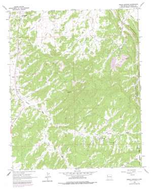
Bread Springs Topo Map New Mexico
To zoom in, hover over the map of Bread Springs
USGS Topo Quad 35108d6 - 1:24,000 scale
| Topo Map Name: | Bread Springs |
| USGS Topo Quad ID: | 35108d6 |
| Print Size: | ca. 21 1/4" wide x 27" high |
| Southeast Coordinates: | 35.375° N latitude / 108.625° W longitude |
| Map Center Coordinates: | 35.4375° N latitude / 108.6875° W longitude |
| U.S. State: | NM |
| Filename: | o35108d6.jpg |
| Download Map JPG Image: | Bread Springs topo map 1:24,000 scale |
| Map Type: | Topographic |
| Topo Series: | 7.5´ |
| Map Scale: | 1:24,000 |
| Source of Map Images: | United States Geological Survey (USGS) |
| Alternate Map Versions: |
Bread Springs NM 1963, updated 1967 Download PDF Buy paper map Bread Springs NM 1963, updated 1979 Download PDF Buy paper map Bread Springs NM 1995, updated 1997 Download PDF Buy paper map Bread Springs NM 2011 Download PDF Buy paper map Bread Springs NM 2013 Download PDF Buy paper map |
| FStopo: | US Forest Service topo Bread Springs is available: Download FStopo PDF Download FStopo TIF |
1:24,000 Topo Quads surrounding Bread Springs
> Back to 35108a1 at 1:100,000 scale
> Back to 35108a1 at 1:250,000 scale
> Back to U.S. Topo Maps home
Bread Springs topo map: Gazetteer
Bread Springs: Arroyos
Pine Tree Wash elevation 2081m 6827′Bread Springs: Mines
Hyde Deposit elevation 2104m 6902′Largo Number 4 Mine elevation 2104m 6902′
Sundance Mine elevation 2190m 7185′
Bread Springs: Populated Places
Bread Springs elevation 2179m 7148′Sundance elevation 2193m 7194′
Bread Springs: Summits
Umbrella Rock elevation 2195m 7201′Bread Springs: Wells
Blue M Well elevation 2066m 6778′Bread Springs Well elevation 2233m 7326′
Browns Well elevation 2084m 6837′
Tah Ha Bah Well elevation 2120m 6955′
Bread Springs digital topo map on disk
Buy this Bread Springs topo map showing relief, roads, GPS coordinates and other geographical features, as a high-resolution digital map file on DVD:


