Mariano Lake Topo Map New Mexico
To zoom in, hover over the map of Mariano Lake
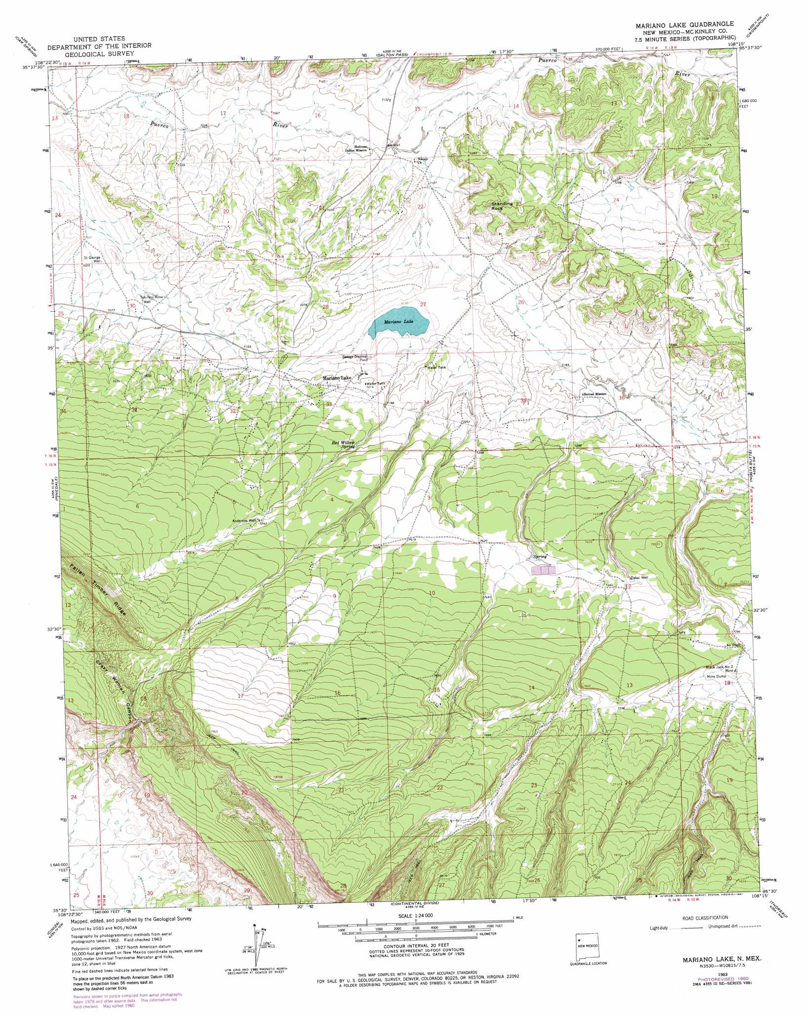
USGS Topo Quad 35108e3 - 1:24,000 scale
| Topo Map Name: | Mariano Lake |
| USGS Topo Quad ID: | 35108e3 |
| Print Size: | ca. 21 1/4" wide x 27" high |
| Southeast Coordinates: | 35.5° N latitude / 108.25° W longitude |
| Map Center Coordinates: | 35.5625° N latitude / 108.3125° W longitude |
| U.S. State: | NM |
| Filename: | o35108e3.jpg |
| Download Map JPG Image: | Mariano Lake topo map 1:24,000 scale |
| Map Type: | Topographic |
| Topo Series: | 7.5´ |
| Map Scale: | 1:24,000 |
| Source of Map Images: | United States Geological Survey (USGS) |
| Alternate Map Versions: |
Mariano Lake NM 1963, updated 1967 Download PDF Buy paper map Mariano Lake NM 1963, updated 1981 Download PDF Buy paper map Mariano Lake NM 2010 Download PDF Buy paper map Mariano Lake NM 2013 Download PDF Buy paper map Mariano Lake NM 2017 Download PDF Buy paper map |
1:24,000 Topo Quads surrounding Mariano Lake
Coyote Canyon |
Toyee |
Standing Rock |
Antelope Lookout Mesa |
Becenti Lake |
Hard Ground Flats |
Oak Spring |
Dalton Pass |
Crownpoint |
Heart Rock |
Church Rock |
Pinedale |
Mariano Lake |
Hosta Butte |
Casamero Lake |
Fort Wingate |
Ciniza |
Continental Divide |
Thoreau |
Thoreau Ne |
Upper Nutria |
Page |
Cottonwood Canyon |
Pine Canyon |
Prewitt |
> Back to 35108e1 at 1:100,000 scale
> Back to 35108a1 at 1:250,000 scale
> Back to U.S. Topo Maps home
Mariano Lake topo map: Gazetteer
Mariano Lake: Dams
Mariano Lake Dam elevation 2174m 7132′Mariano Lake: Mines
Black Jack Mine Number Two elevation 2262m 7421′Mac Number One elevation 2279m 7477′
Mac Number Two elevation 2274m 7460′
Mariano Lake elevation 2260m 7414′
Mariano Lake: Plains
Dutton Plateau elevation 2198m 7211′Mariano Lake: Populated Places
Mariano Lake elevation 2192m 7191′Mariano Lake: Reservoirs
Mariano Lake elevation 2174m 7132′Mariano Lake: Springs
Carvco Spring elevation 2294m 7526′Red Willow Spring elevation 2223m 7293′
Mariano Lake: Summits
Standing Rock elevation 2244m 7362′Mariano Lake: Valleys
Crazy Woman Canyon elevation 2159m 7083′Mariano Lake: Wells
10015 Water Well elevation 2280m 7480′Anderson Well elevation 2265m 7431′
Dakai Well elevation 2257m 7404′
Saint George Well elevation 2143m 7030′
Toh-Noz-Bosa Well elevation 2153m 7063′
Mariano Lake digital topo map on disk
Buy this Mariano Lake topo map showing relief, roads, GPS coordinates and other geographical features, as a high-resolution digital map file on DVD: