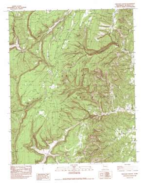
Crevasse Canyon Topo Map New Mexico
To zoom in, hover over the map of Crevasse Canyon
USGS Topo Quad 35108g8 - 1:24,000 scale
| Topo Map Name: | Crevasse Canyon |
| USGS Topo Quad ID: | 35108g8 |
| Print Size: | ca. 21 1/4" wide x 27" high |
| Southeast Coordinates: | 35.75° N latitude / 108.875° W longitude |
| Map Center Coordinates: | 35.8125° N latitude / 108.9375° W longitude |
| U.S. State: | NM |
| Filename: | o35108g8.jpg |
| Download Map JPG Image: | Crevasse Canyon topo map 1:24,000 scale |
| Map Type: | Topographic |
| Topo Series: | 7.5´ |
| Map Scale: | 1:24,000 |
| Source of Map Images: | United States Geological Survey (USGS) |
| Alternate Map Versions: |
Crevasse Canyon NM 1982, updated 1983 Download PDF Buy paper map Crevasse Canyon NM 2010 Download PDF Buy paper map Crevasse Canyon NM 2013 Download PDF Buy paper map |
1:24,000 Topo Quads surrounding Crevasse Canyon
> Back to 35108e1 at 1:100,000 scale
> Back to 35108a1 at 1:250,000 scale
> Back to U.S. Topo Maps home
Crevasse Canyon topo map: Gazetteer
Crevasse Canyon: Areas
Manuelito Plateau elevation 2476m 8123′Crevasse Canyon: Springs
White Clay Spring elevation 2401m 7877′Crevasse Canyon: Valleys
Crevasse Canyon elevation 2073m 6801′Mountain Valley elevation 2123m 6965′
Crevasse Canyon: Wells
14T-508 Water Well elevation 2056m 6745′Howard Becenti Well elevation 2050m 6725′
Crevasse Canyon digital topo map on disk
Buy this Crevasse Canyon topo map showing relief, roads, GPS coordinates and other geographical features, as a high-resolution digital map file on DVD:


