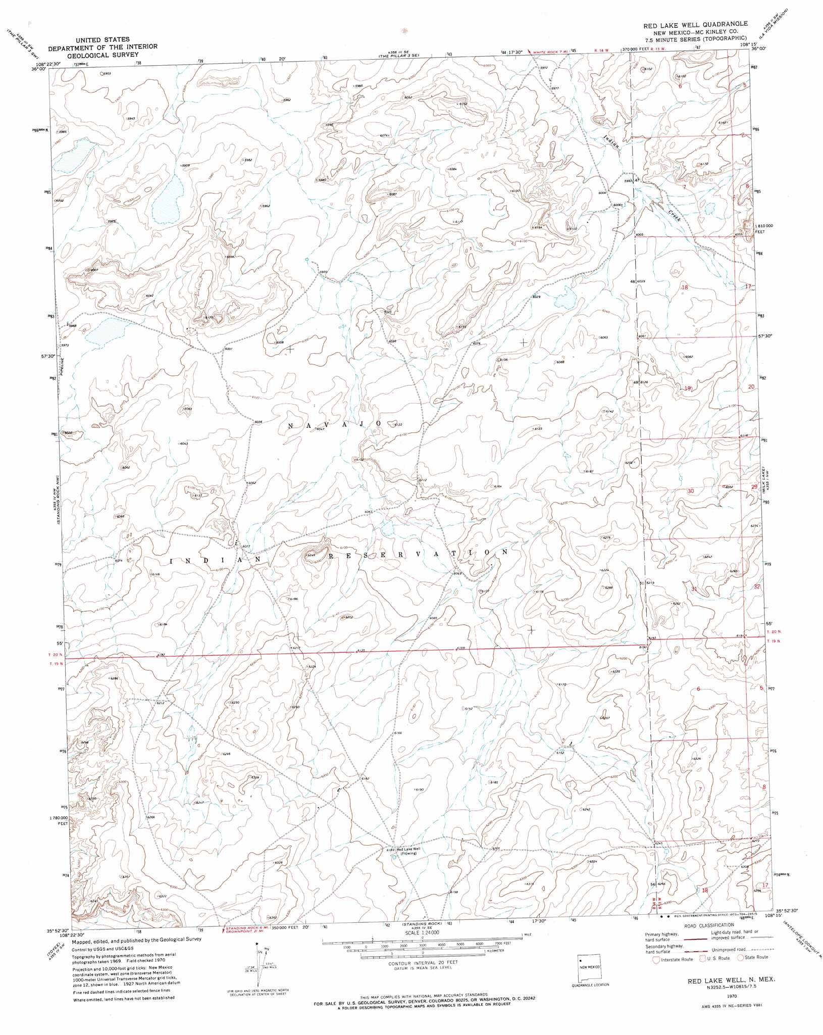
Red Lake Well Topo Map New Mexico
To zoom in, hover over the map of Red Lake Well
USGS Topo Quad 35108h3 - 1:24,000 scale
| Topo Map Name: | Red Lake Well |
| USGS Topo Quad ID: | 35108h3 |
| Print Size: | ca. 21 1/4" wide x 27" high |
| Southeast Coordinates: | 35.875° N latitude / 108.25° W longitude |
| Map Center Coordinates: | 35.9375° N latitude / 108.3125° W longitude |
| U.S. State: | NM |
| Filename: | o35108h3.jpg |
| Download Map JPG Image: | Red Lake Well topo map 1:24,000 scale |
| Map Type: | Topographic |
| Topo Series: | 7.5´ |
| Map Scale: | 1:24,000 |
| Source of Map Images: | United States Geological Survey (USGS) |
| Alternate Map Versions: |
Red Lake Well NM 1970, updated 1973 Download PDF Buy paper map Red Lake Well NM 2010 Download PDF Buy paper map Red Lake Well NM 2013 Download PDF Buy paper map Red Lake Well NM 2017 Download PDF Buy paper map |
1:24,000 Topo Quads surrounding Red Lake Well
Great Bend |
The Pillar 3 Nw |
The Pillar 3 Ne |
Tanner Lake |
Pretty Rock |
Grey Hill Spring |
The Pillar 2 Sw |
The Pillar 3 Se |
La Vida Mission |
Kin Klizhin Ruins |
Ear Rock |
Standing Rock Nw |
Red Lake Well |
Milk Lake |
Nose Rock |
Coyote Canyon |
Toyee |
Standing Rock |
Antelope Lookout Mesa |
Becenti Lake |
Hard Ground Flats |
Oak Spring |
Dalton Pass |
Crownpoint |
Heart Rock |
> Back to 35108e1 at 1:100,000 scale
> Back to 35108a1 at 1:250,000 scale
> Back to U.S. Topo Maps home
Red Lake Well topo map: Gazetteer
Red Lake Well: Wells
15A-12 Water Well elevation 1831m 6007′15B-9 Water Well elevation 1886m 6187′
Red Lake Well elevation 1887m 6190′
Red Lake Well digital topo map on disk
Buy this Red Lake Well topo map showing relief, roads, GPS coordinates and other geographical features, as a high-resolution digital map file on DVD: