High Lonesome Well Topo Map Arizona
To zoom in, hover over the map of High Lonesome Well
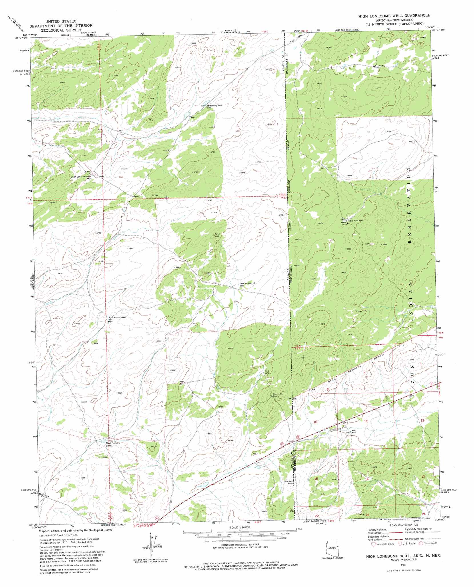
USGS Topo Quad 35109a1 - 1:24,000 scale
| Topo Map Name: | High Lonesome Well |
| USGS Topo Quad ID: | 35109a1 |
| Print Size: | ca. 21 1/4" wide x 27" high |
| Southeast Coordinates: | 35° N latitude / 109° W longitude |
| Map Center Coordinates: | 35.0625° N latitude / 109.0625° W longitude |
| U.S. States: | AZ, NM |
| Filename: | o35109a1.jpg |
| Download Map JPG Image: | High Lonesome Well topo map 1:24,000 scale |
| Map Type: | Topographic |
| Topo Series: | 7.5´ |
| Map Scale: | 1:24,000 |
| Source of Map Images: | United States Geological Survey (USGS) |
| Alternate Map Versions: |
High Lonesome Well AZ 1971, updated 1975 Download PDF Buy paper map High Lonesome Well AZ 2010 Download PDF Buy paper map High Lonesome Well AZ 2011 Download PDF Buy paper map High Lonesome Well AZ 2014 Download PDF Buy paper map |
1:24,000 Topo Quads surrounding High Lonesome Well
Burntwater Wash |
Houck |
Lupton |
Jones Ranch School |
Vander Wagen |
Sanders |
Tolapai Spring |
Chafin Well |
Chi Chil Tah |
Vanderwagen Draw |
Beacon Well |
Deep Lake |
High Lonesome Well |
Tekapo |
Zuni |
Fairchild Well |
Wild Cow Lake |
Barth Well |
Ojo Caliente Reservoir |
Plumasano Basin |
Prospect Spring |
Ceadro Spring |
Ceadro Spring Se |
Venadito Camp |
Atarque Lake |
> Back to 35109a1 at 1:100,000 scale
> Back to 35108a1 at 1:250,000 scale
> Back to U.S. Topo Maps home
High Lonesome Well topo map: Gazetteer
High Lonesome Well: Reservoirs
East Pasture Tank elevation 1984m 6509′High Lonesome Well: Wells
Devil Pass Well elevation 2020m 6627′East Well Number Eleven elevation 2021m 6630′
High Lonesome Well digital topo map on disk
Buy this High Lonesome Well topo map showing relief, roads, GPS coordinates and other geographical features, as a high-resolution digital map file on DVD: