Tanner Springs Topo Map Arizona
To zoom in, hover over the map of Tanner Springs
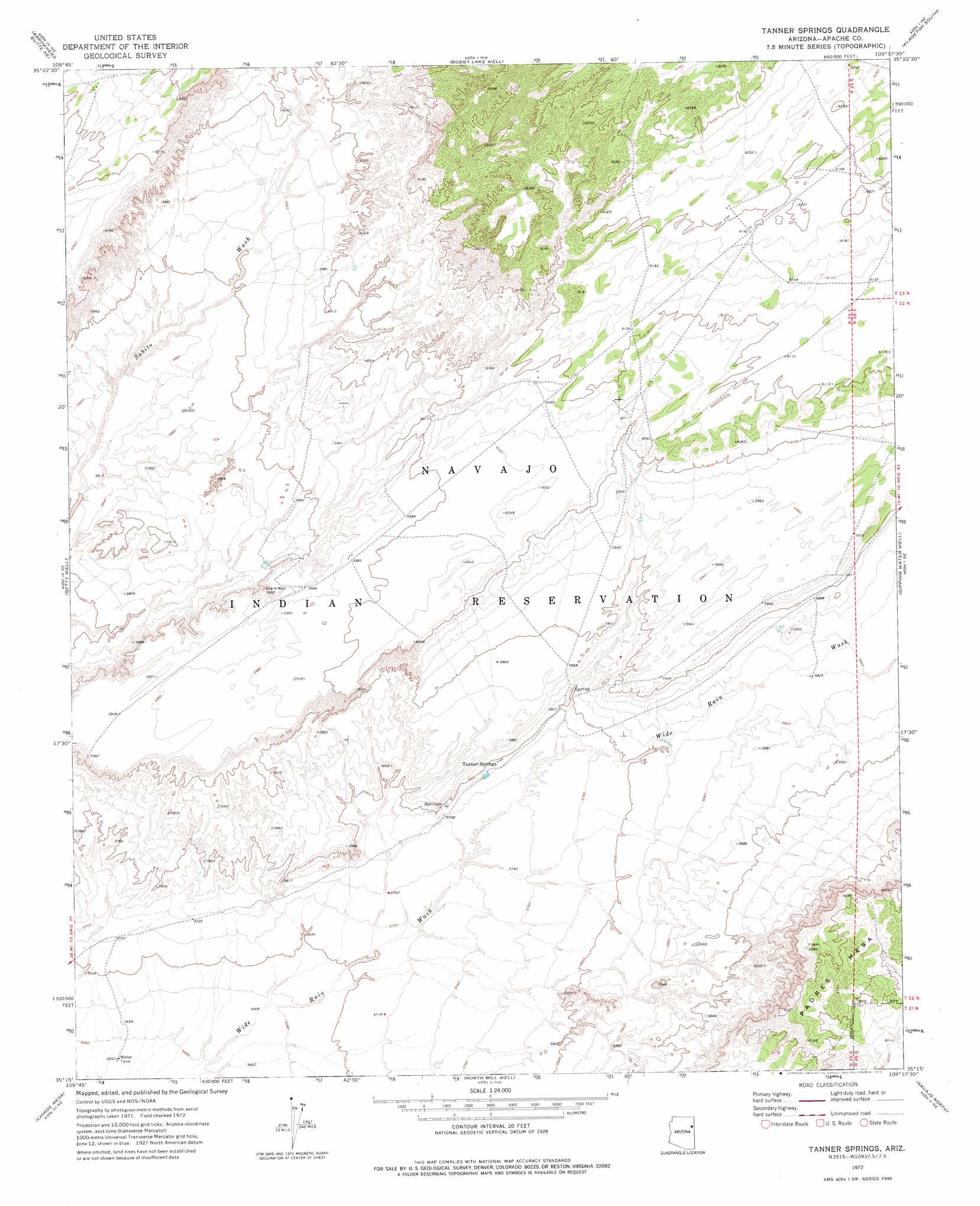
USGS Topo Quad 35109c6 - 1:24,000 scale
| Topo Map Name: | Tanner Springs |
| USGS Topo Quad ID: | 35109c6 |
| Print Size: | ca. 21 1/4" wide x 27" high |
| Southeast Coordinates: | 35.25° N latitude / 109.625° W longitude |
| Map Center Coordinates: | 35.3125° N latitude / 109.6875° W longitude |
| U.S. State: | AZ |
| Filename: | o35109c6.jpg |
| Download Map JPG Image: | Tanner Springs topo map 1:24,000 scale |
| Map Type: | Topographic |
| Topo Series: | 7.5´ |
| Map Scale: | 1:24,000 |
| Source of Map Images: | United States Geological Survey (USGS) |
| Alternate Map Versions: |
Tanner Springs AZ 1972, updated 1975 Download PDF Buy paper map Tanner Springs AZ 2011 Download PDF Buy paper map Tanner Springs AZ 2014 Download PDF Buy paper map |
1:24,000 Topo Quads surrounding Tanner Springs
Satan Butte |
Greasewood |
Sunrise Springs |
Klagetoh North |
Tudecoz Spring |
Greasewood Spring |
Arrowhead Butte Ne |
Boggy Lake Well |
Klagetoh South |
Wide Ruins |
Arrowhead Butte |
Betty Well |
Tanner Springs |
Dipping Water Well |
Wide Ruins Sw |
Pilot Rock |
Chinde Mesa |
North Mill Well |
Navajo North |
Chambers |
Little Lithodendron Tank |
Kachina Point |
Pinta |
Navajo South |
Navajo Springs |
> Back to 35109a1 at 1:100,000 scale
> Back to 35108a1 at 1:250,000 scale
> Back to U.S. Topo Maps home
Tanner Springs topo map: Gazetteer
Tanner Springs: Populated Places
Tanner Springs elevation 1764m 5787′Tanner Springs digital topo map on disk
Buy this Tanner Springs topo map showing relief, roads, GPS coordinates and other geographical features, as a high-resolution digital map file on DVD: