Boggy Lake Well Topo Map Arizona
To zoom in, hover over the map of Boggy Lake Well
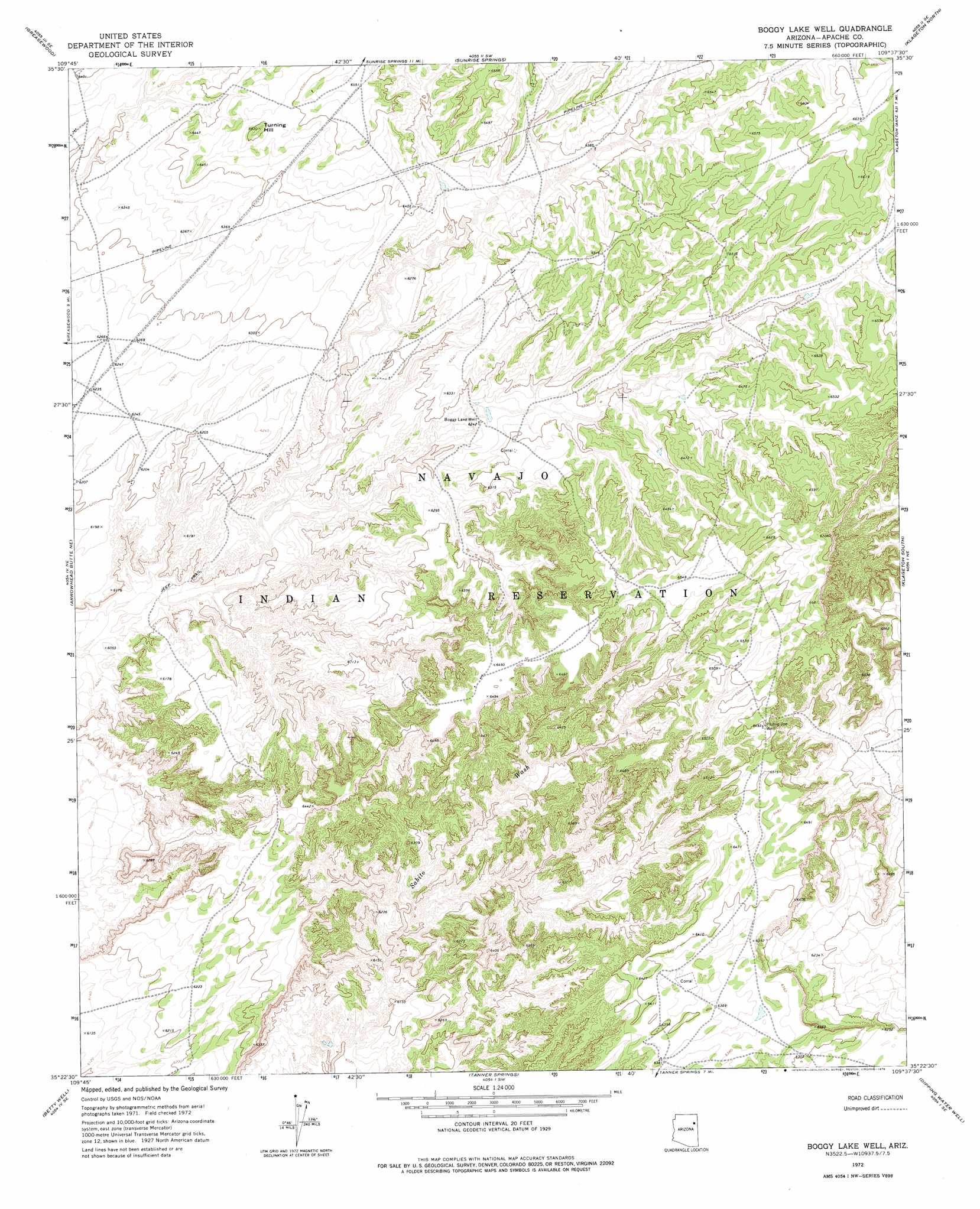
USGS Topo Quad 35109d6 - 1:24,000 scale
| Topo Map Name: | Boggy Lake Well |
| USGS Topo Quad ID: | 35109d6 |
| Print Size: | ca. 21 1/4" wide x 27" high |
| Southeast Coordinates: | 35.375° N latitude / 109.625° W longitude |
| Map Center Coordinates: | 35.4375° N latitude / 109.6875° W longitude |
| U.S. State: | AZ |
| Filename: | o35109d6.jpg |
| Download Map JPG Image: | Boggy Lake Well topo map 1:24,000 scale |
| Map Type: | Topographic |
| Topo Series: | 7.5´ |
| Map Scale: | 1:24,000 |
| Source of Map Images: | United States Geological Survey (USGS) |
| Alternate Map Versions: |
Boggy Lake Well AZ 1972, updated 1976 Download PDF Buy paper map Boggy Lake Well AZ 2011 Download PDF Buy paper map Boggy Lake Well AZ 2014 Download PDF Buy paper map |
1:24,000 Topo Quads surrounding Boggy Lake Well
Toyei School |
Steamboat Canyon |
Cornfields |
Ganado |
Kinlichee |
Satan Butte |
Greasewood |
Sunrise Springs |
Klagetoh North |
Tudecoz Spring |
Greasewood Spring |
Arrowhead Butte Ne |
Boggy Lake Well |
Klagetoh South |
Wide Ruins |
Arrowhead Butte |
Betty Well |
Tanner Springs |
Dipping Water Well |
Wide Ruins Sw |
Pilot Rock |
Chinde Mesa |
North Mill Well |
Navajo North |
Chambers |
> Back to 35109a1 at 1:100,000 scale
> Back to 35108a1 at 1:250,000 scale
> Back to U.S. Topo Maps home
Boggy Lake Well topo map: Gazetteer
Boggy Lake Well: Summits
Turning Hill elevation 1987m 6519′Boggy Lake Well: Wells
Boggy Lake Well elevation 1904m 6246′Phillip Joe Well elevation 1981m 6499′
Boggy Lake Well digital topo map on disk
Buy this Boggy Lake Well topo map showing relief, roads, GPS coordinates and other geographical features, as a high-resolution digital map file on DVD: