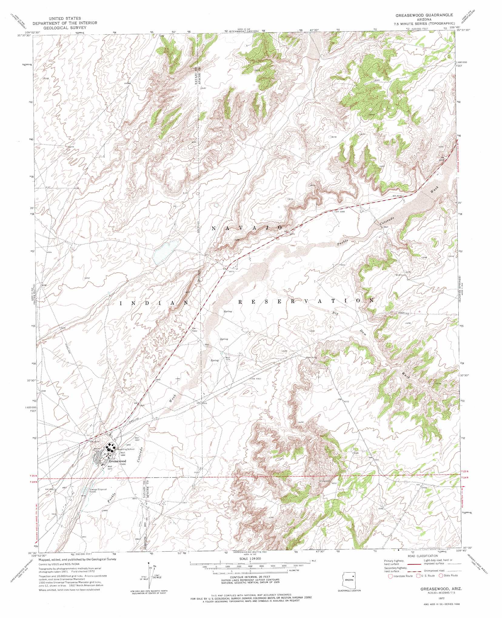
Greasewood Topo Map Arizona
To zoom in, hover over the map of Greasewood
USGS Topo Quad 35109e7 - 1:24,000 scale
| Topo Map Name: | Greasewood |
| USGS Topo Quad ID: | 35109e7 |
| Print Size: | ca. 21 1/4" wide x 27" high |
| Southeast Coordinates: | 35.5° N latitude / 109.75° W longitude |
| Map Center Coordinates: | 35.5625° N latitude / 109.8125° W longitude |
| U.S. State: | AZ |
| Filename: | o35109e7.jpg |
| Download Map JPG Image: | Greasewood topo map 1:24,000 scale |
| Map Type: | Topographic |
| Topo Series: | 7.5´ |
| Map Scale: | 1:24,000 |
| Source of Map Images: | United States Geological Survey (USGS) |
| Alternate Map Versions: |
Greasewood AZ 1972, updated 1975 Download PDF Buy paper map Greasewood AZ 2011 Download PDF Buy paper map Greasewood AZ 2014 Download PDF Buy paper map |
1:24,000 Topo Quads surrounding Greasewood
Lamb Well |
Big Willow Spring Canyon |
Steamboat Rock |
Ganado Mesa Sw |
Ganado Mesa |
Tsin Naan Tee |
Toyei School |
Steamboat Canyon |
Cornfields |
Ganado |
White Cone |
Satan Butte |
Greasewood |
Sunrise Springs |
Klagetoh North |
Indian Wells |
Greasewood Spring |
Arrowhead Butte Ne |
Boggy Lake Well |
Klagetoh South |
Five Buttes |
Arrowhead Butte |
Betty Well |
Tanner Springs |
Dipping Water Well |
> Back to 35109e1 at 1:100,000 scale
> Back to 35108a1 at 1:250,000 scale
> Back to U.S. Topo Maps home
Greasewood topo map: Gazetteer
Greasewood: Airports
Greasewood Airport elevation 1823m 5980′Greasewood: Populated Places
Greasewood elevation 1802m 5912′Greasewood: Valleys
Big Dam Wash elevation 1820m 5971′Greasewood digital topo map on disk
Buy this Greasewood topo map showing relief, roads, GPS coordinates and other geographical features, as a high-resolution digital map file on DVD: