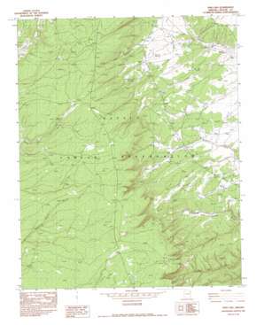
Piney Hill Topo Map Arizona
To zoom in, hover over the map of Piney Hill
USGS Topo Quad 35109g2 - 1:24,000 scale
| Topo Map Name: | Piney Hill |
| USGS Topo Quad ID: | 35109g2 |
| Print Size: | ca. 21 1/4" wide x 27" high |
| Southeast Coordinates: | 35.75° N latitude / 109.125° W longitude |
| Map Center Coordinates: | 35.8125° N latitude / 109.1875° W longitude |
| U.S. State: | AZ |
| Filename: | o35109g2.jpg |
| Download Map JPG Image: | Piney Hill topo map 1:24,000 scale |
| Map Type: | Topographic |
| Topo Series: | 7.5´ |
| Map Scale: | 1:24,000 |
| Source of Map Images: | United States Geological Survey (USGS) |
| Alternate Map Versions: |
Zith-Tusayan Butte 1 SW AZ 1955, updated 1958 Download PDF Buy paper map Piney Hill AZ 1982, updated 1983 Download PDF Buy paper map Piney Hill AZ 2011 Download PDF Buy paper map Piney Hill AZ 2014 Download PDF Buy paper map |
1:24,000 Topo Quads surrounding Piney Hill
> Back to 35109e1 at 1:100,000 scale
> Back to 35108a1 at 1:250,000 scale
> Back to U.S. Topo Maps home
Piney Hill topo map: Gazetteer
Piney Hill: Flats
Talhchoze Tohe Meadow elevation 2276m 7467′Piney Hill: Plains
Defiance Plateau elevation 2389m 7837′Piney Hill: Springs
Beehbito Spring elevation 2376m 7795′Bonito Spring elevation 2356m 7729′
Cold Spring elevation 2245m 7365′
Piney Hill: Streams
Deer Springs Creek elevation 2304m 7559′Piney Hill: Summits
Piney Hill elevation 2471m 8106′Piney Hill digital topo map on disk
Buy this Piney Hill topo map showing relief, roads, GPS coordinates and other geographical features, as a high-resolution digital map file on DVD:


