Steamboat Rock Topo Map Arizona
To zoom in, hover over the map of Steamboat Rock
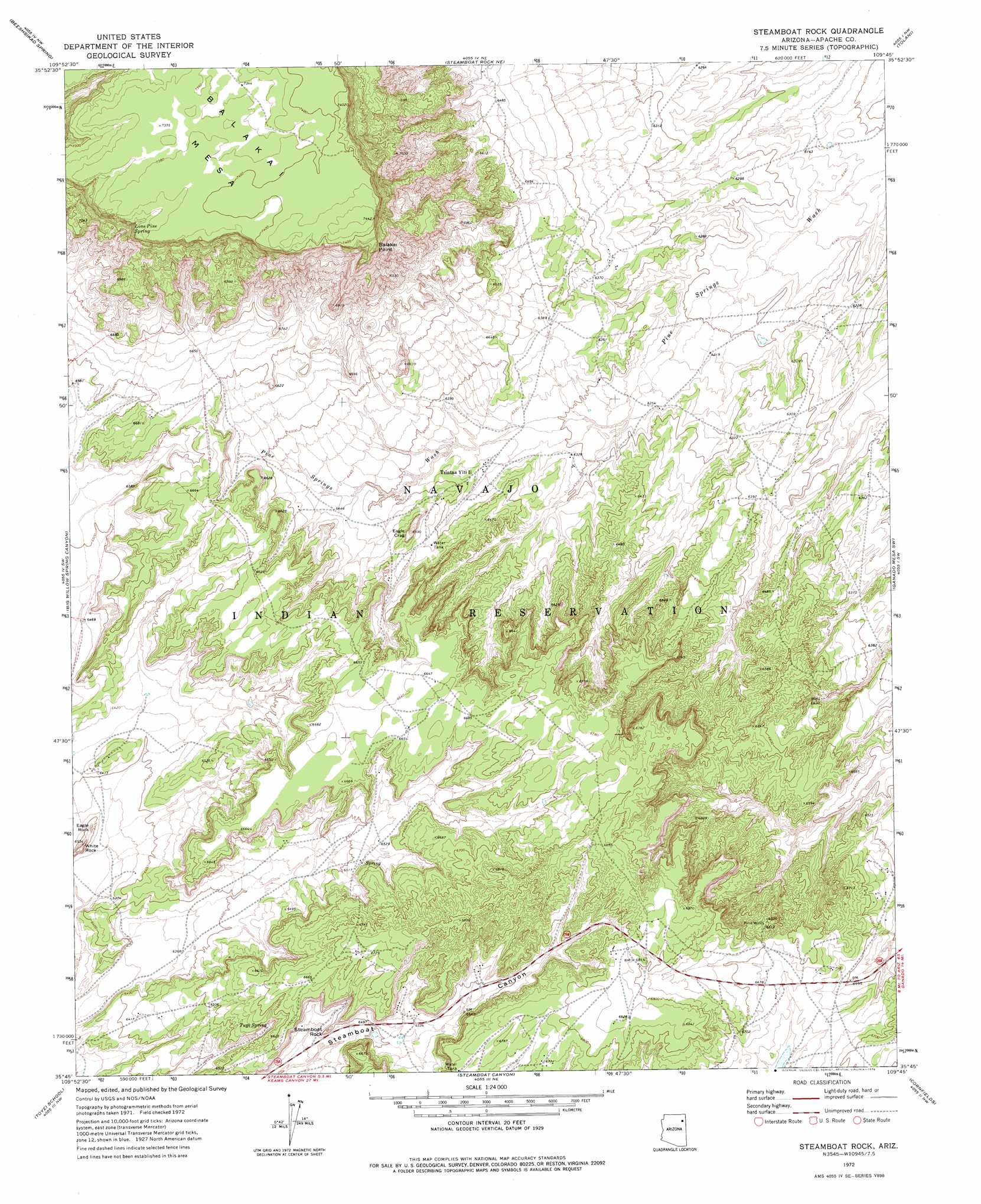
USGS Topo Quad 35109g7 - 1:24,000 scale
| Topo Map Name: | Steamboat Rock |
| USGS Topo Quad ID: | 35109g7 |
| Print Size: | ca. 21 1/4" wide x 27" high |
| Southeast Coordinates: | 35.75° N latitude / 109.75° W longitude |
| Map Center Coordinates: | 35.8125° N latitude / 109.8125° W longitude |
| U.S. State: | AZ |
| Filename: | o35109g7.jpg |
| Download Map JPG Image: | Steamboat Rock topo map 1:24,000 scale |
| Map Type: | Topographic |
| Topo Series: | 7.5´ |
| Map Scale: | 1:24,000 |
| Source of Map Images: | United States Geological Survey (USGS) |
| Alternate Map Versions: |
Steamboat Rock AZ 1972, updated 1976 Download PDF Buy paper map Steamboat Rock AZ 2011 Download PDF Buy paper map Steamboat Rock AZ 2014 Download PDF Buy paper map |
1:24,000 Topo Quads surrounding Steamboat Rock
Whippoorwill Spring |
Toadimdaaska Mesa |
Salina |
Toh De Niihe |
Little White House Ruins |
Low Mountain |
Beeshsikad Spring |
Steamboat Rock Ne |
Tolani |
Beautiful Valley Well |
Lamb Well |
Big Willow Spring Canyon |
Steamboat Rock |
Ganado Mesa Sw |
Ganado Mesa |
Tsin Naan Tee |
Toyei School |
Steamboat Canyon |
Cornfields |
Ganado |
White Cone |
Satan Butte |
Greasewood |
Sunrise Springs |
Klagetoh North |
> Back to 35109e1 at 1:100,000 scale
> Back to 35108a1 at 1:250,000 scale
> Back to U.S. Topo Maps home
Steamboat Rock topo map: Gazetteer
Steamboat Rock: Populated Places
Steamboat elevation 2002m 6568′Tsintaa Yiti Ii elevation 1935m 6348′
Steamboat Rock: Springs
Lone Pine Spring elevation 2215m 7267′Tuye Spring elevation 1982m 6502′
Steamboat Rock: Summits
Balakai Point elevation 2122m 6961′Eagle Crag elevation 2004m 6574′
Eagle Rock elevation 1977m 6486′
Steamboat Rock elevation 2006m 6581′
White Rock elevation 1983m 6505′
Steamboat Rock: Wells
Pine Wells elevation 2018m 6620′Steamboat Rock digital topo map on disk
Buy this Steamboat Rock topo map showing relief, roads, GPS coordinates and other geographical features, as a high-resolution digital map file on DVD: