Beeshsikad Spring Topo Map Arizona
To zoom in, hover over the map of Beeshsikad Spring
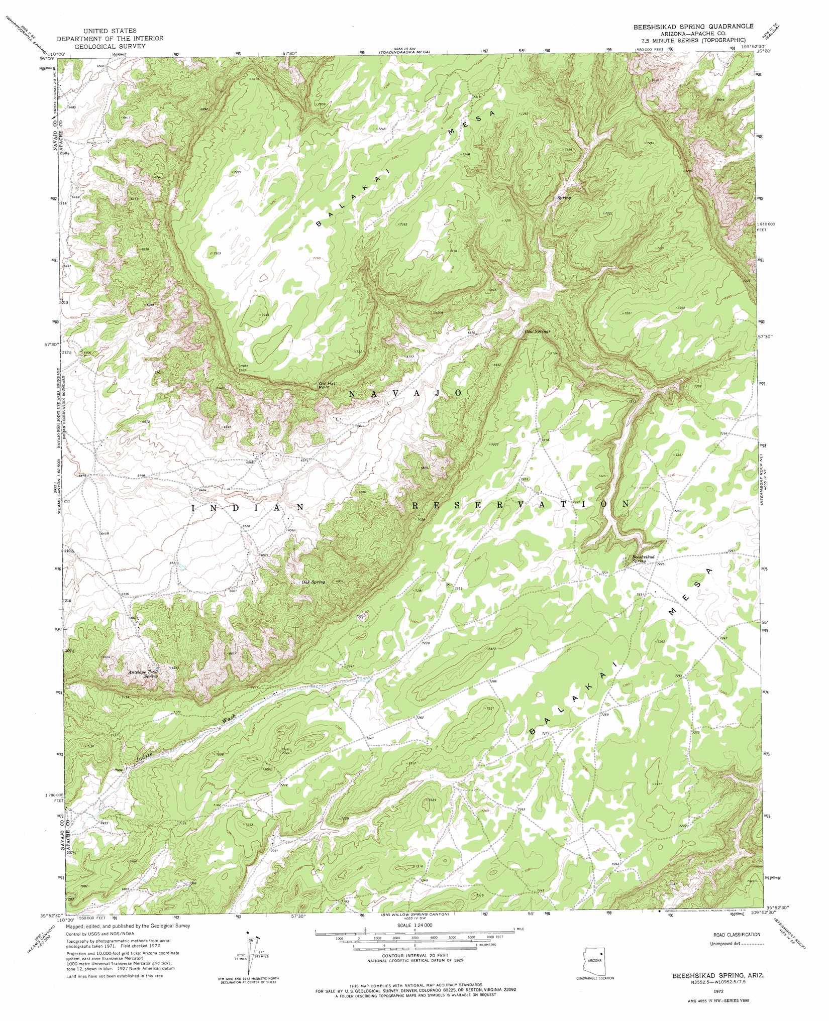
USGS Topo Quad 35109h8 - 1:24,000 scale
| Topo Map Name: | Beeshsikad Spring |
| USGS Topo Quad ID: | 35109h8 |
| Print Size: | ca. 21 1/4" wide x 27" high |
| Southeast Coordinates: | 35.875° N latitude / 109.875° W longitude |
| Map Center Coordinates: | 35.9375° N latitude / 109.9375° W longitude |
| U.S. State: | AZ |
| Filename: | o35109h8.jpg |
| Download Map JPG Image: | Beeshsikad Spring topo map 1:24,000 scale |
| Map Type: | Topographic |
| Topo Series: | 7.5´ |
| Map Scale: | 1:24,000 |
| Source of Map Images: | United States Geological Survey (USGS) |
| Alternate Map Versions: |
Beeshsikad Spring AZ 1972, updated 1976 Download PDF Buy paper map Beeshsikad Spring AZ 2011 Download PDF Buy paper map Beeshsikad Spring AZ 2014 Download PDF Buy paper map |
1:24,000 Topo Quads surrounding Beeshsikad Spring
Pinon Nw |
Burnt Corn Spring |
Blue Gap |
Lohali Point |
Ventana Mesa |
Pinon |
Whippoorwill Spring |
Toadimdaaska Mesa |
Salina |
Toh De Niihe |
Echo Canyon |
Low Mountain |
Beeshsikad Spring |
Steamboat Rock Ne |
Tolani |
Keams Canyon |
Lamb Well |
Big Willow Spring Canyon |
Steamboat Rock |
Ganado Mesa Sw |
Jadito Spring |
Tsin Naan Tee |
Toyei School |
Steamboat Canyon |
Cornfields |
> Back to 35109e1 at 1:100,000 scale
> Back to 35108a1 at 1:250,000 scale
> Back to U.S. Topo Maps home
Beeshsikad Spring topo map: Gazetteer
Beeshsikad Spring: Springs
Antelope Trail Spring elevation 2044m 6706′Beeshsikad Spring elevation 2185m 7168′
Cow Springs elevation 2102m 6896′
Oak Spring elevation 2064m 6771′
Beeshsikad Spring: Summits
Balakai Mesa elevation 2222m 7290′Owl Hat Point elevation 2135m 7004′
Beeshsikad Spring digital topo map on disk
Buy this Beeshsikad Spring topo map showing relief, roads, GPS coordinates and other geographical features, as a high-resolution digital map file on DVD: