Hennessy Buttes Topo Map Arizona
To zoom in, hover over the map of Hennessy Buttes
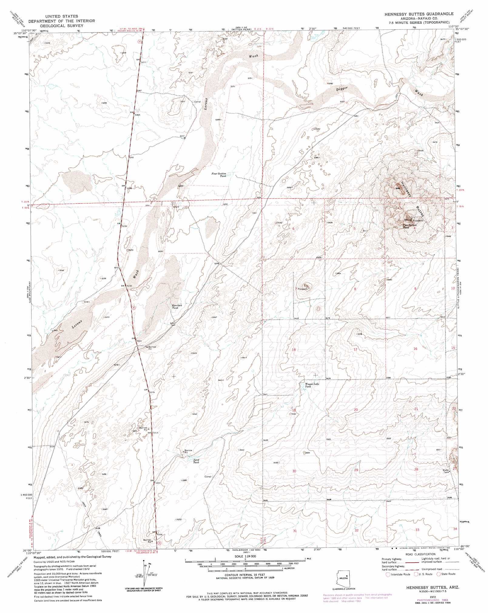
USGS Topo Quad 35110a1 - 1:24,000 scale
| Topo Map Name: | Hennessy Buttes |
| USGS Topo Quad ID: | 35110a1 |
| Print Size: | ca. 21 1/4" wide x 27" high |
| Southeast Coordinates: | 35° N latitude / 110° W longitude |
| Map Center Coordinates: | 35.0625° N latitude / 110.0625° W longitude |
| U.S. State: | AZ |
| Filename: | o35110a1.jpg |
| Download Map JPG Image: | Hennessy Buttes topo map 1:24,000 scale |
| Map Type: | Topographic |
| Topo Series: | 7.5´ |
| Map Scale: | 1:24,000 |
| Source of Map Images: | United States Geological Survey (USGS) |
| Alternate Map Versions: |
Hennessy Buttes AZ 1972, updated 1975 Download PDF Buy paper map Hennessy Buttes AZ 1972, updated 1983 Download PDF Buy paper map Hennessy Buttes AZ 2011 Download PDF Buy paper map Hennessy Buttes AZ 2014 Download PDF Buy paper map |
1:24,000 Topo Quads surrounding Hennessy Buttes
French Butte |
Sunflower Butte |
Five Buttes |
Arrowhead Butte |
Betty Well |
Rotten Bananas Butte |
Turkey Track Butte |
Mitten Peak |
Pilot Rock |
Chinde Mesa |
Blairs Spring |
Lee Mountain |
Hennessy Buttes |
Little Lithodendron Tank |
Kachina Point |
Joseph City |
Holbrook |
Sun Valley |
Carrizo Butte |
Adamana |
Saunders Draw |
Porter Canyon |
Woodruff |
Padilla Tank |
Agate House |
> Back to 35110a1 at 1:100,000 scale
> Back to 35110a1 at 1:250,000 scale
> Back to U.S. Topo Maps home
Hennessy Buttes topo map: Gazetteer
Hennessy Buttes: Reservoirs
Four Section Tank elevation 1605m 5265′Sand Tank elevation 0m 0′
Spurlock Tank elevation 1595m 5232′
Two Section Tank elevation 1719m 5639′
Wagon Lake Tank elevation 1662m 5452′
Hennessy Buttes: Streams
Digger Wash elevation 1606m 5269′Hennessy Buttes: Summits
Hennessy Buttes elevation 1783m 5849′Hennessy Buttes digital topo map on disk
Buy this Hennessy Buttes topo map showing relief, roads, GPS coordinates and other geographical features, as a high-resolution digital map file on DVD: