Elephant Butte Topo Map Arizona
To zoom in, hover over the map of Elephant Butte
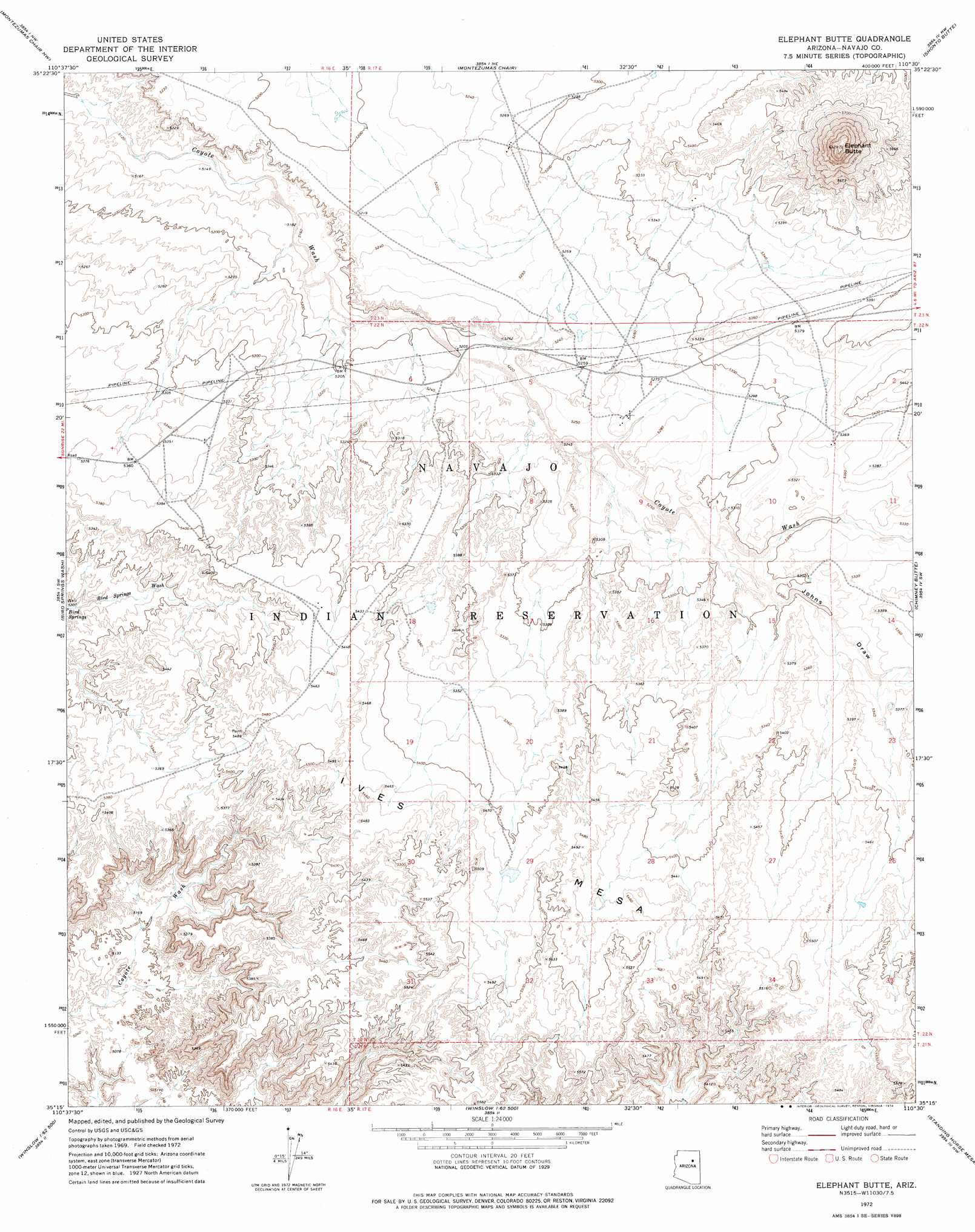
USGS Topo Quad 35110c5 - 1:24,000 scale
| Topo Map Name: | Elephant Butte |
| USGS Topo Quad ID: | 35110c5 |
| Print Size: | ca. 21 1/4" wide x 27" high |
| Southeast Coordinates: | 35.25° N latitude / 110.5° W longitude |
| Map Center Coordinates: | 35.3125° N latitude / 110.5625° W longitude |
| U.S. State: | AZ |
| Filename: | o35110c5.jpg |
| Download Map JPG Image: | Elephant Butte topo map 1:24,000 scale |
| Map Type: | Topographic |
| Topo Series: | 7.5´ |
| Map Scale: | 1:24,000 |
| Source of Map Images: | United States Geological Survey (USGS) |
| Alternate Map Versions: |
Elephant Butte AZ 1972, updated 1974 Download PDF Buy paper map Elephant Butte AZ 2011 Download PDF Buy paper map Elephant Butte AZ 2014 Download PDF Buy paper map |
1:24,000 Topo Quads surrounding Elephant Butte
Garces Mesas Se |
Tovar Mesa West |
Tovar Mesa East |
Egloffstein Butte |
Hauke Mesa |
Tolani Lake |
Montezumas Chair Nw |
Montezumas Chair |
Shonto Butte |
Dilkon |
East Of Old Leupp |
Bird Springs Wash |
Elephant Butte |
Chimney Butte |
French Butte |
Tucker Mesa Ne |
Winslow Nw |
Winslow Ne |
Standing Horse Mesa |
Rotten Bananas Butte |
Tucker Mesa |
Winslow |
Rincon Ranch |
Humpy Camp Well |
Blairs Spring |
> Back to 35110a1 at 1:100,000 scale
> Back to 35110a1 at 1:250,000 scale
> Back to U.S. Topo Maps home
Elephant Butte topo map: Gazetteer
Elephant Butte: Summits
Elephant Butte elevation 1929m 6328′Elephant Butte: Valleys
Johns Draw elevation 1616m 5301′Elephant Butte digital topo map on disk
Buy this Elephant Butte topo map showing relief, roads, GPS coordinates and other geographical features, as a high-resolution digital map file on DVD: