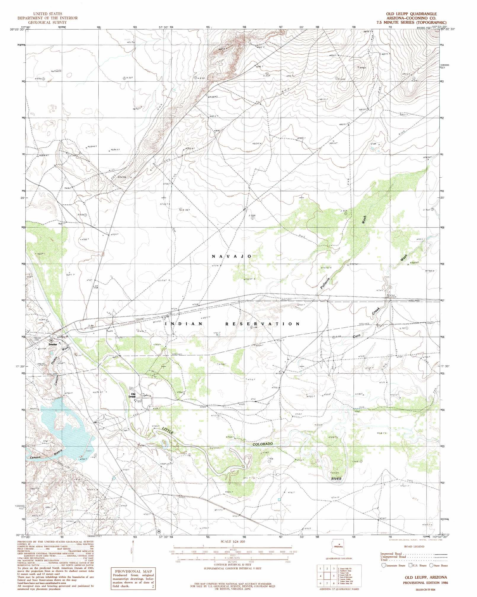
Old Leupp Topo Map Arizona
To zoom in, hover over the map of Old Leupp
USGS Topo Quad 35110c8 - 1:24,000 scale
| Topo Map Name: | Old Leupp |
| USGS Topo Quad ID: | 35110c8 |
| Print Size: | ca. 21 1/4" wide x 27" high |
| Southeast Coordinates: | 35.25° N latitude / 110.875° W longitude |
| Map Center Coordinates: | 35.3125° N latitude / 110.9375° W longitude |
| U.S. State: | AZ |
| Filename: | o35110c8.jpg |
| Download Map JPG Image: | Old Leupp topo map 1:24,000 scale |
| Map Type: | Topographic |
| Topo Series: | 7.5´ |
| Map Scale: | 1:24,000 |
| Source of Map Images: | United States Geological Survey (USGS) |
| Alternate Map Versions: |
Winslow 2 SW AZ 1955, updated 1957 Download PDF Buy paper map Old Leupp AZ 1986, updated 1986 Download PDF Buy paper map Old Leupp AZ 2011 Download PDF Buy paper map Old Leupp AZ 2014 Download PDF Buy paper map |
1:24,000 Topo Quads surrounding Old Leupp
Standing Rocks |
White Water Tank |
Monument Point |
Garces Mesas Se |
Tovar Mesa West |
Grand Falls |
Grand Falls Ne |
Newberry Mesa |
Tolani Lake |
Montezumas Chair Nw |
Grand Falls Sw |
Grand Falls Se |
Old Leupp |
East Of Old Leupp |
Bird Springs Wash |
Babbitt Wash |
Canyon Diablo |
Tucker Mesa Nw |
Tucker Mesa Ne |
Winslow Nw |
Anderson Canyon |
Meteor Crater |
Tucker Mesa Sw |
Tucker Mesa |
Winslow |
> Back to 35110a1 at 1:100,000 scale
> Back to 35110a1 at 1:250,000 scale
> Back to U.S. Topo Maps home
Old Leupp topo map: Gazetteer
Old Leupp: Airports
Sunrise Airfield elevation 1446m 4744′Old Leupp: Arroyos
Canyon Diablo Wash elevation 1429m 4688′Old Leupp: Populated Places
Old Leupp elevation 1433m 4701′Sunrise elevation 1430m 4691′
Old Leupp: Post Offices
Leupp Post Office elevation 1434m 4704′Old Leupp: Streams
Corn Creek Wash elevation 1435m 4708′Old Leupp: Valleys
Canyon Diablo elevation 1429m 4688′Old Leupp digital topo map on disk
Buy this Old Leupp topo map showing relief, roads, GPS coordinates and other geographical features, as a high-resolution digital map file on DVD: