Tolani Lake Topo Map Arizona
To zoom in, hover over the map of Tolani Lake
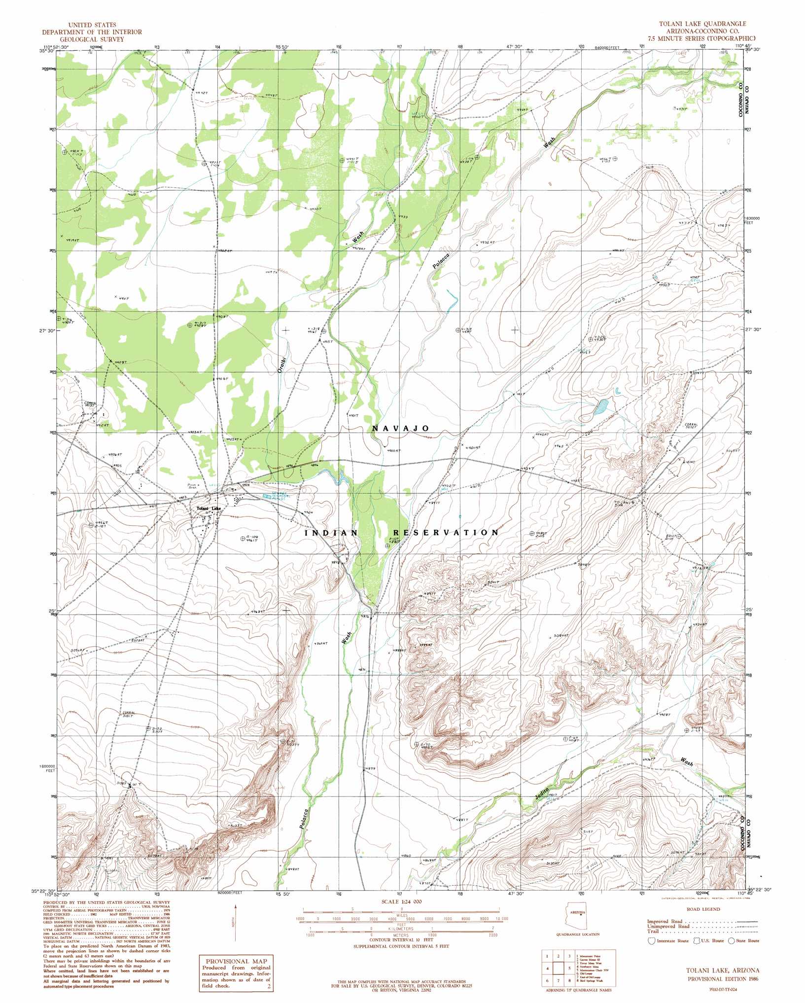
USGS Topo Quad 35110d7 - 1:24,000 scale
| Topo Map Name: | Tolani Lake |
| USGS Topo Quad ID: | 35110d7 |
| Print Size: | ca. 21 1/4" wide x 27" high |
| Southeast Coordinates: | 35.375° N latitude / 110.75° W longitude |
| Map Center Coordinates: | 35.4375° N latitude / 110.8125° W longitude |
| U.S. State: | AZ |
| Filename: | o35110d7.jpg |
| Download Map JPG Image: | Tolani Lake topo map 1:24,000 scale |
| Map Type: | Topographic |
| Topo Series: | 7.5´ |
| Map Scale: | 1:24,000 |
| Source of Map Images: | United States Geological Survey (USGS) |
| Alternate Map Versions: |
Tolani Lake AZ 1986, updated 1986 Download PDF Buy paper map Tolani Lake AZ 2011 Download PDF Buy paper map Tolani Lake AZ 2014 Download PDF Buy paper map |
1:24,000 Topo Quads surrounding Tolani Lake
Rock Head |
Sand Springs |
Garces Mesas Ne |
Burro Spring |
Giants Chair |
White Water Tank |
Monument Point |
Garces Mesas Se |
Tovar Mesa West |
Tovar Mesa East |
Grand Falls Ne |
Newberry Mesa |
Tolani Lake |
Montezumas Chair Nw |
Montezumas Chair |
Grand Falls Se |
Old Leupp |
East Of Old Leupp |
Bird Springs Wash |
Elephant Butte |
Canyon Diablo |
Tucker Mesa Nw |
Tucker Mesa Ne |
Winslow Nw |
Winslow Ne |
> Back to 35110a1 at 1:100,000 scale
> Back to 35110a1 at 1:250,000 scale
> Back to U.S. Topo Maps home
Tolani Lake topo map: Gazetteer
Tolani Lake: Arroyos
Oraibi Wash elevation 1489m 4885′Whe-yol-da-sah Wash elevation 1491m 4891′
Tolani Lake: Populated Places
Tolani Lake elevation 1499m 4917′Tolani Lake digital topo map on disk
Buy this Tolani Lake topo map showing relief, roads, GPS coordinates and other geographical features, as a high-resolution digital map file on DVD: