Garces Mesas Se Topo Map Arizona
To zoom in, hover over the map of Garces Mesas Se
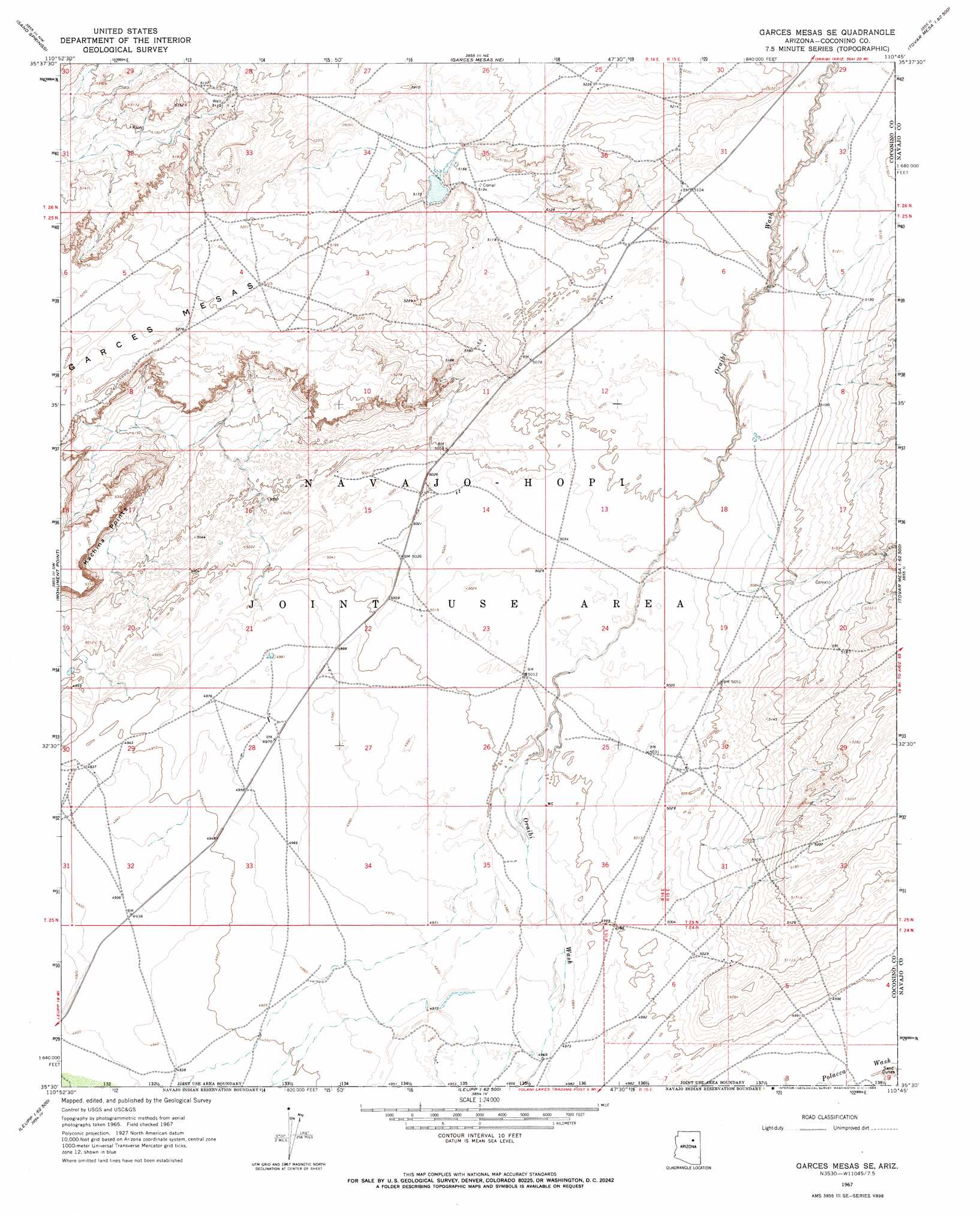
USGS Topo Quad 35110e7 - 1:24,000 scale
| Topo Map Name: | Garces Mesas Se |
| USGS Topo Quad ID: | 35110e7 |
| Print Size: | ca. 21 1/4" wide x 27" high |
| Southeast Coordinates: | 35.5° N latitude / 110.75° W longitude |
| Map Center Coordinates: | 35.5625° N latitude / 110.8125° W longitude |
| U.S. State: | AZ |
| Filename: | o35110e7.jpg |
| Download Map JPG Image: | Garces Mesas Se topo map 1:24,000 scale |
| Map Type: | Topographic |
| Topo Series: | 7.5´ |
| Map Scale: | 1:24,000 |
| Source of Map Images: | United States Geological Survey (USGS) |
| Alternate Map Versions: |
Garces Mesas SE AZ 1967, updated 1969 Download PDF Buy paper map Garces Mesas SE AZ 2011 Download PDF Buy paper map Garces Mesas SE AZ 2014 Download PDF Buy paper map |
1:24,000 Topo Quads surrounding Garces Mesas Se
Gold Spring |
Dinnebito Spring |
Padilla Mesa |
Mount Beautiful |
Shongopovi |
Rock Head |
Sand Springs |
Garces Mesas Ne |
Burro Spring |
Giants Chair |
White Water Tank |
Monument Point |
Garces Mesas Se |
Tovar Mesa West |
Tovar Mesa East |
Grand Falls Ne |
Newberry Mesa |
Tolani Lake |
Montezumas Chair Nw |
Montezumas Chair |
Grand Falls Se |
Old Leupp |
East Of Old Leupp |
Bird Springs Wash |
Elephant Butte |
> Back to 35110e1 at 1:100,000 scale
> Back to 35110a1 at 1:250,000 scale
> Back to U.S. Topo Maps home
Garces Mesas Se topo map: Gazetteer
Garces Mesas Se: Summits
Garces Mesas elevation 1610m 5282′Kachina Points elevation 1629m 5344′
Garces Mesas Se digital topo map on disk
Buy this Garces Mesas Se topo map showing relief, roads, GPS coordinates and other geographical features, as a high-resolution digital map file on DVD: