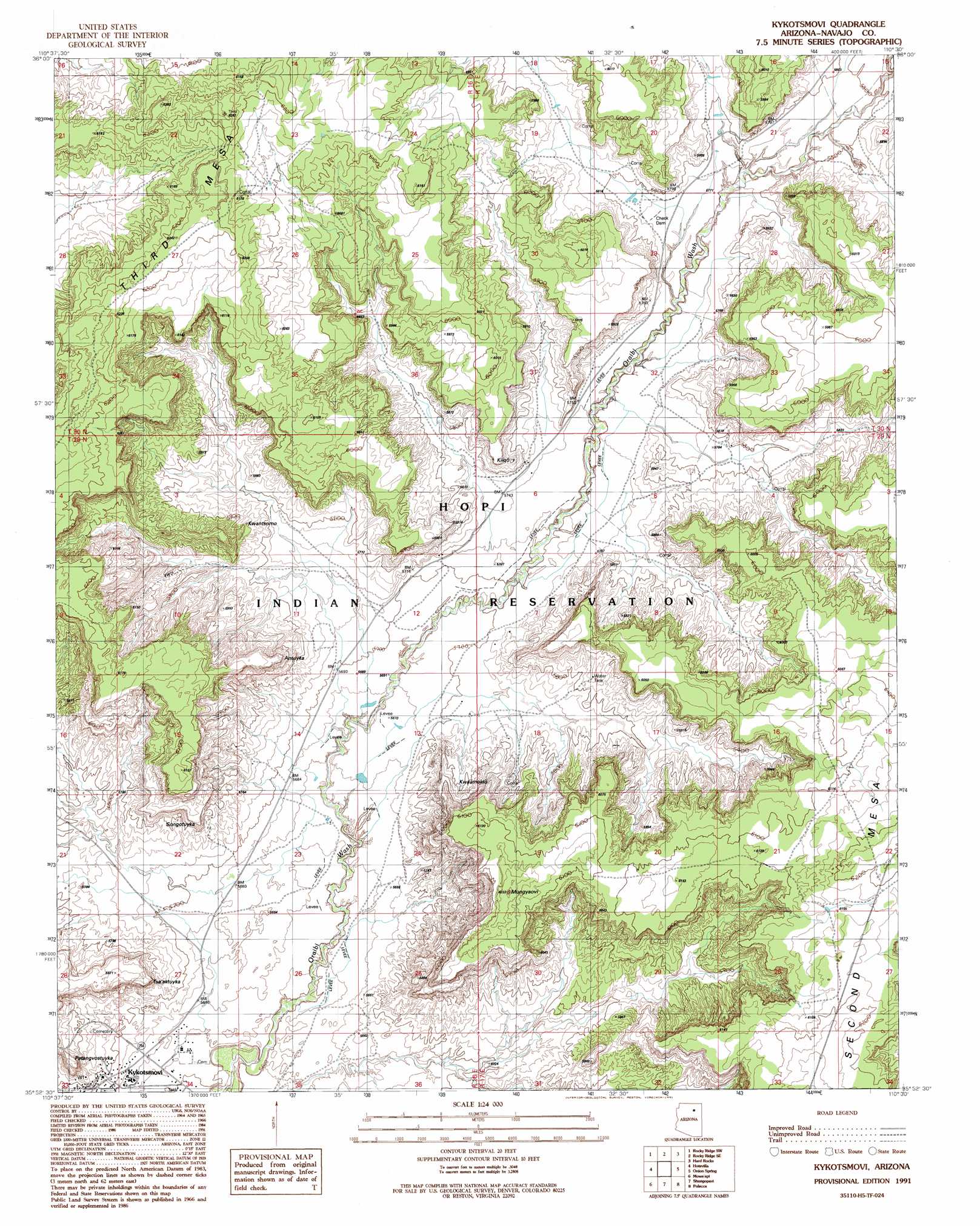
Oraibi Topo Map Arizona
To zoom in, hover over the map of Oraibi
USGS Topo Quad 35110h5 - 1:24,000 scale
| Topo Map Name: | Oraibi |
| USGS Topo Quad ID: | 35110h5 |
| Print Size: | ca. 21 1/4" wide x 27" high |
| Southeast Coordinates: | 35.875° N latitude / 110.5° W longitude |
| Map Center Coordinates: | 35.9375° N latitude / 110.5625° W longitude |
| U.S. State: | AZ |
| Filename: | o35110h5.jpg |
| Download Map JPG Image: | Oraibi topo map 1:24,000 scale |
| Map Type: | Topographic |
| Topo Series: | 7.5´ |
| Map Scale: | 1:24,000 |
| Source of Map Images: | United States Geological Survey (USGS) |
| Alternate Map Versions: |
Kykotsmovi AZ 1991, updated 1991 Download PDF Buy paper map Kykotsmovi AZ 2011 Download PDF Buy paper map Kykotsmovi AZ 2014 Download PDF Buy paper map |
1:24,000 Topo Quads surrounding Oraibi
Pillars Of Hercules |
Rocky Ridge Nw |
Rocky Ridge Ne |
Big Mountain Dam |
Coat Spring |
Bat Spring |
Rocky Ridge Sw |
Rocky Ridge Se |
Hard Rocks |
Little Black Spot Mountain |
Howell Mesa |
Hotevilla |
Oraibi |
Onion Spring |
Wepo Village |
Padilla Mesa |
Mount Beautiful |
Shongopovi |
Polacca |
Sun Altar |
Garces Mesas Ne |
Burro Spring |
Giants Chair |
Snake Butte |
Star Mountain |
> Back to 35110e1 at 1:100,000 scale
> Back to 35110a1 at 1:250,000 scale
> Back to U.S. Topo Maps home
Oraibi topo map: Gazetteer
Oraibi: Populated Places
Kykotsmovi elevation 1730m 5675′Oraibi: Post Offices
Oraibi Post Office elevation 1726m 5662′Oraibi: Summits
Kiiqö elevation 1799m 5902′Patangvostuyqa elevation 1744m 5721′
Second Mesa elevation 1883m 6177′
Oraibi digital topo map on disk
Buy this Oraibi topo map showing relief, roads, GPS coordinates and other geographical features, as a high-resolution digital map file on DVD: