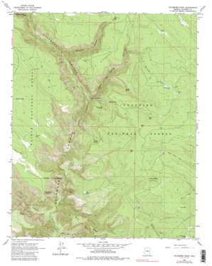
Sycamore Point Topo Map Arizona
To zoom in, hover over the map of Sycamore Point
USGS Topo Quad 35111a8 - 1:24,000 scale
| Topo Map Name: | Sycamore Point |
| USGS Topo Quad ID: | 35111a8 |
| Print Size: | ca. 21 1/4" wide x 27" high |
| Southeast Coordinates: | 35° N latitude / 111.875° W longitude |
| Map Center Coordinates: | 35.0625° N latitude / 111.9375° W longitude |
| U.S. State: | AZ |
| Filename: | o35111a8.jpg |
| Download Map JPG Image: | Sycamore Point topo map 1:24,000 scale |
| Map Type: | Topographic |
| Topo Series: | 7.5´ |
| Map Scale: | 1:24,000 |
| Source of Map Images: | United States Geological Survey (USGS) |
| Alternate Map Versions: |
Sycamore Point AZ 1963, updated 1965 Download PDF Buy paper map Sycamore Point AZ 1963, updated 1971 Download PDF Buy paper map Sycamore Point AZ 1963, updated 1982 Download PDF Buy paper map Sycamore Point AZ 1963, updated 1987 Download PDF Buy paper map Sycamore Point AZ 2012 Download PDF Buy paper map Sycamore Point AZ 2014 Download PDF Buy paper map |
| FStopo: | US Forest Service topo Sycamore Point is available: Download FStopo PDF Download FStopo TIF |
1:24,000 Topo Quads surrounding Sycamore Point
> Back to 35111a1 at 1:100,000 scale
> Back to 35110a1 at 1:250,000 scale
> Back to U.S. Topo Maps home
Sycamore Point topo map: Gazetteer
Sycamore Point: Cliffs
Sycamore Point elevation 1929m 6328′Sycamore Point: Dams
Kennedy Dam elevation 1940m 6364′Sycamore Point: Flats
LO Pocket elevation 2005m 6578′Thumb Flat elevation 1962m 6437′
Sycamore Point: Lakes
Lost Lake elevation 2156m 7073′Ott Lake elevation 1815m 5954′
Sycamore Point: Reservoirs
BT Tank elevation 1949m 6394′Casner Tank elevation 2132m 6994′
Colcord Tank elevation 1988m 6522′
Corner Tank elevation 2164m 7099′
Deer Tank elevation 2011m 6597′
Everett Tank elevation 2093m 6866′
Flag Tank elevation 2095m 6873′
Handcock Tank elevation 2080m 6824′
Hog Hill Tank elevation 2153m 7063′
LO Pocket Tank elevation 1966m 6450′
Mooney Tank elevation 2133m 6998′
Power Tank elevation 2096m 6876′
Railroad Draw Tanks elevation 2127m 6978′
Rankin Tank elevation 1994m 6541′
Rinehart Tank elevation 2177m 7142′
Secret Tank elevation 2000m 6561′
Sycamore Tank elevation 1892m 6207′
Trail Tank elevation 2085m 6840′
Tram Tank elevation 2124m 6968′
Turkey Butte Tank elevation 2181m 7155′
Turkey Number Two Tank elevation 2146m 7040′
Turkey Tank elevation 2074m 6804′
Sycamore Point: Ridges
Buck Ridge elevation 1946m 6384′Sycamore Point: Springs
Babes Hole Spring elevation 1796m 5892′Colcord Spring elevation 1891m 6204′
Dorsey Spring elevation 1890m 6200′
Geronimo Spring elevation 1582m 5190′
Kelsey Spring elevation 1933m 6341′
Strahan Spring elevation 1917m 6289′
Winter Cabin Spring elevation 1911m 6269′
Sycamore Point: Streams
Little L O Spring Canyon elevation 1561m 5121′Volunteer Wash elevation 1632m 5354′
Sycamore Point: Summits
Colcord Hill elevation 2025m 6643′Hog Hill elevation 2209m 7247′
Red Hill elevation 2222m 7290′
Turkey Butte elevation 2245m 7365′
Sycamore Point: Trails
Dorsey Spring Trail elevation 2049m 6722′Kelsey Winter Trail elevation 1881m 6171′
Little Lookout Trail elevation 1752m 5748′
Taylor Cabin Trail elevation 1497m 4911′
Winter Cabin Trail elevation 1857m 6092′
Sycamore Point: Valleys
Big Spring Canyon elevation 1768m 5800′Colcord Canyon elevation 1523m 4996′
Railroad Draw elevation 1888m 6194′
Tule Canyon elevation 1389m 4557′
Volunteer Canyon elevation 1633m 5357′
Sycamore Point digital topo map on disk
Buy this Sycamore Point topo map showing relief, roads, GPS coordinates and other geographical features, as a high-resolution digital map file on DVD:


