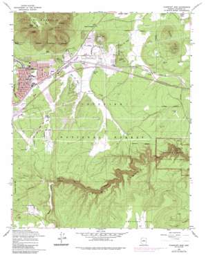
Flagstaff East Topo Map Arizona
To zoom in, hover over the map of Flagstaff East
USGS Topo Quad 35111b5 - 1:24,000 scale
| Topo Map Name: | Flagstaff East |
| USGS Topo Quad ID: | 35111b5 |
| Print Size: | ca. 21 1/4" wide x 27" high |
| Southeast Coordinates: | 35.125° N latitude / 111.5° W longitude |
| Map Center Coordinates: | 35.1875° N latitude / 111.5625° W longitude |
| U.S. State: | AZ |
| Filename: | o35111b5.jpg |
| Download Map JPG Image: | Flagstaff East topo map 1:24,000 scale |
| Map Type: | Topographic |
| Topo Series: | 7.5´ |
| Map Scale: | 1:24,000 |
| Source of Map Images: | United States Geological Survey (USGS) |
| Alternate Map Versions: |
Flagstaff East AZ 1962, updated 1965 Download PDF Buy paper map Flagstaff East AZ 1962, updated 1970 Download PDF Buy paper map Flagstaff East AZ 1962, updated 1976 Download PDF Buy paper map Flagstaff East AZ 1962, updated 1983 Download PDF Buy paper map Flagstaff East AZ 1962, updated 1986 Download PDF Buy paper map Flagstaff East AZ 1962, updated 1986 Download PDF Buy paper map Flagstaff East AZ 2011 Download PDF Buy paper map Flagstaff East AZ 2014 Download PDF Buy paper map |
| FStopo: | US Forest Service topo Flagstaff East is available: Download FStopo PDF Download FStopo TIF |
1:24,000 Topo Quads surrounding Flagstaff East
> Back to 35111a1 at 1:100,000 scale
> Back to 35110a1 at 1:250,000 scale
> Back to U.S. Topo Maps home
Flagstaff East topo map: Gazetteer
Flagstaff East: Airports
Flagstaff Mall Heliport elevation 2084m 6837′Flagstaff East: Basins
Bottomless Pit elevation 2062m 6765′Devils Chair elevation 2504m 8215′
Flagstaff East: Cliffs
Fisher Point elevation 2095m 6873′Flagstaff East: Crossings
Butler Avenue Interchange elevation 2088m 6850′Cosnino Overpass elevation 2038m 6686′
East Flagstaff Interchange elevation 2081m 6827′
Fourth Street Underpass elevation 2095m 6873′
Walnut Canyon Interchange elevation 2032m 6666′
Flagstaff East: Dams
Continental Dam Number Three elevation 2093m 6866′Continental Number One Dam elevation 2089m 6853′
Continental Number Two Dam elevation 2099m 6886′
Flagstaff East: Flats
Turkey Park elevation 2739m 8986′Flagstaff East: Lakes
Big Fill Lake elevation 2065m 6774′Flagstaff East: Parks
Bushmaster Park elevation 2100m 6889′Linda Vista Park elevation 2134m 7001′
Mount Elden Little League Field elevation 2092m 6863′
Paradise Hills Park elevation 2126m 6975′
Ponderosa Recreation Center elevation 2101m 6893′
Smoke Rise Park elevation 2100m 6889′
Walnut Canyon National Monument elevation 1990m 6528′
Flagstaff East: Populated Places
East Flagstaff elevation 2096m 6876′Elden Pueblo elevation 2116m 6942′
Flagstaff East: Post Offices
East Flagstaff Branch Post Office elevation 2092m 6863′Flagstaff East: Reservoirs
Bear Tank elevation 2124m 6968′Breezy Tank elevation 2028m 6653′
Campbell Tank elevation 2012m 6601′
Dry Tank elevation 2124m 6968′
Elaine Lake elevation 2084m 6837′
Fisher Guzzler Trick Tank elevation 2132m 6994′
Hassel Tank elevation 2128m 6981′
Hoffman Tank elevation 2078m 6817′
Humphrey Lake elevation 2089m 6853′
Limestone Tank elevation 2086m 6843′
Log Cabin Tank elevation 2062m 6765′
Maureen Lake elevation 2079m 6820′
Monument Tank elevation 2035m 6676′
Sheep Hill Tank elevation 2089m 6853′
Smith Tank elevation 2074m 6804′
Thirteen Tank elevation 1999m 6558′
Upper Tank elevation 2177m 7142′
Flagstaff East: Springs
Elden Spring elevation 2151m 7057′Lion Spring elevation 2095m 6873′
Oak Spring elevation 2480m 8136′
Paradies Spring elevation 2164m 7099′
Flagstaff East: Summits
Devils Head elevation 2782m 9127′Sheep Hill elevation 2248m 7375′
T V Hill elevation 2797m 9176′
Turkey Hills elevation 2263m 7424′
Wildcat Hill elevation 2136m 7007′
Flagstaff East: Trails
Walnut Canyon Loop Trail elevation 1969m 6459′Flagstaff East: Valleys
Fay Canyon elevation 2018m 6620′Lake Mary Valley elevation 2018m 6620′
Skunk Canyon elevation 2018m 6620′
Flagstaff East digital topo map on disk
Buy this Flagstaff East topo map showing relief, roads, GPS coordinates and other geographical features, as a high-resolution digital map file on DVD:


